Payl:NWCoast1a.png

Walay mas taas nga resolusyon.
NWCoast1a.png (761 × 529 pixels, size sa payl: 172 KB, MIME type: image/png)

|
This map image could be re-created using vector graphics as an SVG file. This has several advantages; see Commons:Media for cleanup for more information. If an SVG form of this image is available, please upload it and afterwards replace this template with
{{vector version available|new image name}}.
It is recommended to name the SVG file “NWCoast1a.svg”—then the template Vector version available (or Vva) does not need the new image name parameter. |
Mubong sugid:
| Deskripsyon |
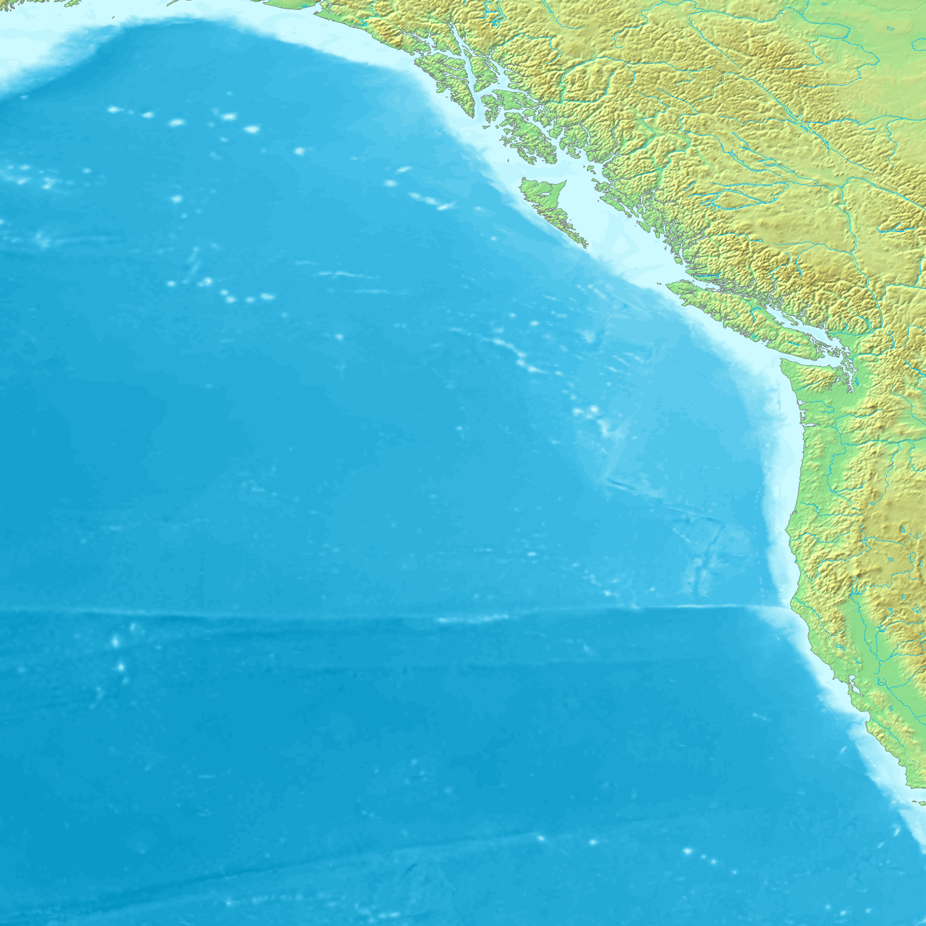
Map of the coast of the Pacific Northwest --- Islands and major straits of the northern American pacific coast showing Prince of Wales Island (Alaska), Queen Charlotte Sound (Canada), Dixon Entrance, Hecate Strait, Baranof Island, Chichagof Island, Juneau Icefield, Stikine Icecap and other |
| Gigikanan | http://en.wikipedia.org/wiki/Image:NWCoast1a.png — — — This is adapted from a regional Topographic map made from GEMS data that is already posted on Wikimedia Commons. Original map created from DEMIS Mapserver, which are public domain. |
| Tagsulat | en:User:Koba-chan |
Pagtugot

|
Gitugot ang pagkopya, pag-apud-apod o/ug pag-usab ning maong dokumento ubos sa mga termino sa GNU Free Documentation License, Version 1.2 o mas bag-ong bersiyon nga gimantala sa Free Software Foundation; nga walay Invariant Sections, walay Front-Cover Texts, ug walay Back-Cover Texts. Ang kopya sa lisensiya gilakip sa bahin nga giulohang GNU Free Documentation License. |
| This file is licensed under the Creative Commons Attribution-Share Alike 3.0 Unported license. | ||
| ||
| This licensing tag was added to this file as part of the GFDL licensing update. |
Kaagi sa payl
I-klik ang petsa/oras aron makit-an ang hulagway sa payl niadtong panahona.
| Petsa/Takna | Thumbnail | Mga dimensyon | Tiggamit | Komento | |
|---|---|---|---|---|---|
| kasamtangan | 11:24, 1 Septiyembre 2006 | | 761 × 529 (172 KB) | Mattes | {{Information |Description=Map of the coast of the Pacific Northwest --- Islands and major straits of the northern American pacific coast showing Prince of Wales Island (Alaska), Queen Charlotte Sound (Canada), Dixon Entrance, Hecate Strait, Baranof Isla |
Mga paggamit sa payl
Ang mosunod nga 10 panid misumpay niining payl:
Global nga paggamit sa payl
Kining ubang wiki naggamit ning maong payl:
- Paggamit sa ar.wikipedia.org
- Paggamit sa arz.wikipedia.org
- Paggamit sa az.wikipedia.org
- Paggamit sa be.wikipedia.org
- Paggamit sa ca.wikipedia.org
- Paggamit sa cs.wikipedia.org
- Paggamit sa de.wikipedia.org
- Paggamit sa el.wikipedia.org
- Paggamit sa en.wikipedia.org
- Paggamit sa en.wikivoyage.org
- Paggamit sa eo.wikipedia.org
- Paggamit sa es.wikipedia.org
View more global usage of this file.