Payl:Nice-night-view-with-blurred-cars 1200x900.jpg
Gidak-on ning maong paunang tan-aw: 800 x 600 ka mga piksel. Uban pang mga resoluyon: 320 x 240 ka mga piksel | 640 x 480 ka mga piksel | 1,024 x 768 ka mga piksel | 1,200 x 900 ka mga piksel.
Tibuok resolusyon (1,200 × 900 pixels, size sa payl: 165 KB, MIME type: image/jpeg)
|
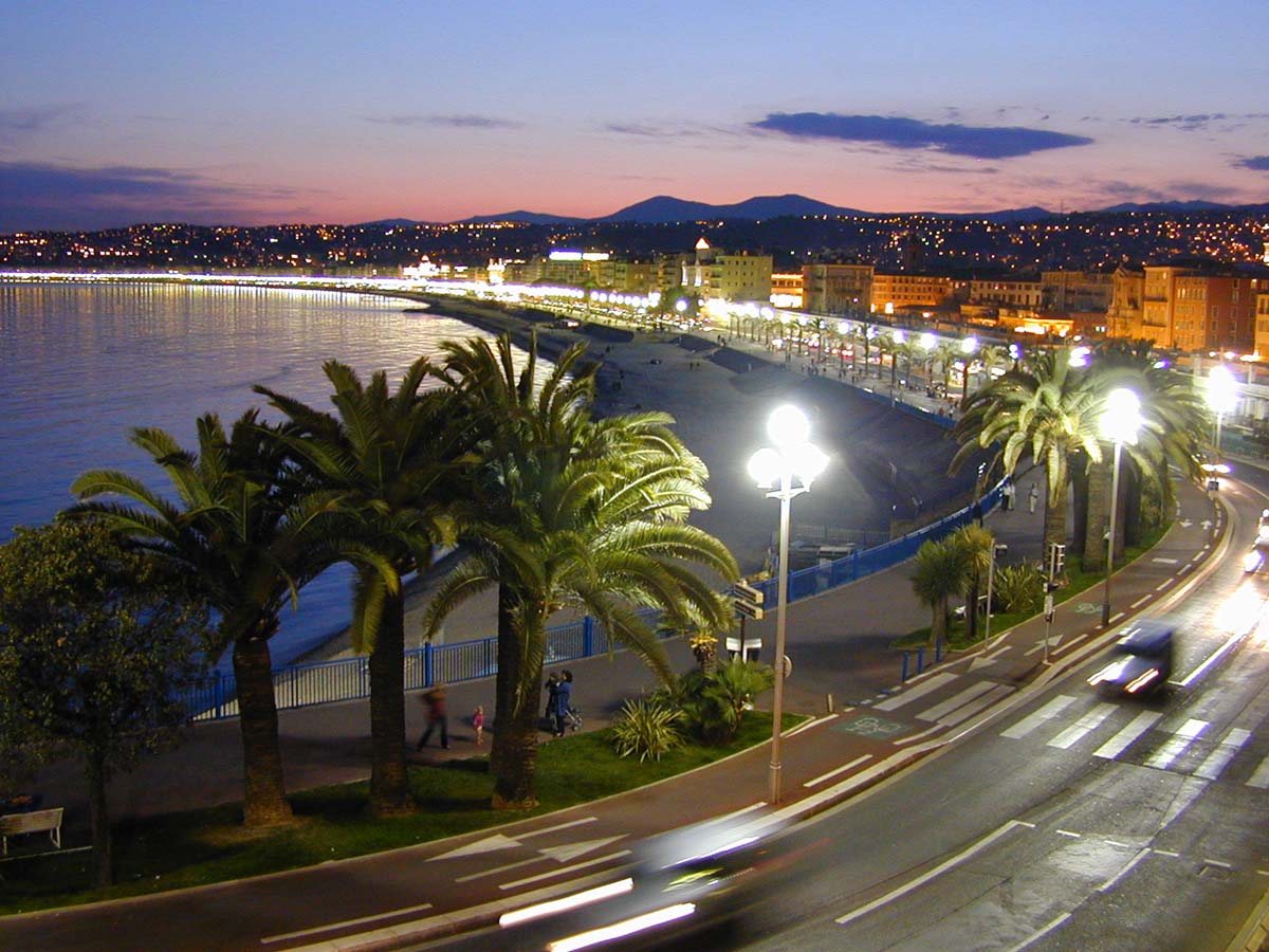
This image was selected as picture of the day on Wikimedia Commons for 2 January 2007. It was captioned as follows: English: the "Promenade des Anglais" in Nice Other languages:
Bân-lâm-gú: Nice ê "Promenade des Anglais" Čeština: Anglická promenáda (Promenade des Anglais) v Nice Dansk: Promenade des Anglais i Nice. Deutsch: Die Promenade des Anglais (Spazierweg der Engländer) in Nizza. English: the "Promenade des Anglais" in Nice Esperanto: La "Promenade des Anglais" (Promenejo de la Angloj) en Nico. Gaeilge: "Promenade des Anglais" (Promanád na Sasanach) i Nice. Galego: O "Paseo dos Ingleses" en Niza Italiano: Promenade des Anglais a Nizza. Magyar: „Promenade des Anglais”, Nizza Română: O imagine nocturnă a "Promenade des Anglais" din Nisa. Sicilianu: Promenade des Anglais a Nizza. Suomi: Promenade des Anglais-katu Nizzassa Svenska: Promenade des Anglais i Nice. Türkçe: Promenade des Anglais sahili yolu. Nice, Fransa. Български: "Promenade des Anglais" / "Английският крайбрежен булевард" в Ница, Франция Русский: Promenade des Anglais в Ницце 한국어: 니스의 프롬나드 데 장글레 日本語: ニースのプロムナード・デザングレ العربية : نزهة الانجليز في نيس |
Mubong sugid:
| Deskripsyon | A view along the Quai des États-Unis and the Promenade des Anglais in Nice at night. Picture taken from the hotel Suisse. | ||||||||
| Petsa | Abril 2004 | ||||||||
| Gigikanan | Kaugalingong trabaho | ||||||||
| Tagsulat | W. M. Connolley | ||||||||
| Pagtugot (Paggamit pag-usab niini nga file) |
|

| Camera location | | View this and other nearby images on: OpenStreetMap |
|---|
Kaagi sa payl
I-klik ang petsa/oras aron makit-an ang hulagway sa payl niadtong panahona.
| Petsa/Takna | Thumbnail | Mga dimensyon | Tiggamit | Komento | |
|---|---|---|---|---|---|
| kasamtangan | 22:29, 8 Nobiyembre 2004 | | 1,200 × 900 (165 KB) | Kotasik | {{GFDL}} from EN-WIKI |
Mga paggamit sa payl
Ang mosunod nga mga panid misumpay niining payl:
Global nga paggamit sa payl
Kining ubang wiki naggamit ning maong payl:
- Paggamit sa af.wikipedia.org
- Paggamit sa als.wikipedia.org
- Paggamit sa an.wikipedia.org
- Paggamit sa ar.wikipedia.org
- Paggamit sa azb.wikipedia.org
- Paggamit sa ban.wikipedia.org
- Paggamit sa be-tarask.wikipedia.org
- Paggamit sa be.wikipedia.org
- Paggamit sa bn.wikipedia.org
- Paggamit sa bs.wikipedia.org
- Paggamit sa bxr.wikipedia.org
- Paggamit sa ca.wikipedia.org
- Paggamit sa ckb.wikipedia.org
- Paggamit sa cs.wikipedia.org
- Paggamit sa cv.wikipedia.org
- Paggamit sa da.wikipedia.org
- Paggamit sa de.wikipedia.org
- Vorlage:Infobox Gemeinde in Frankreich
- Benutzer:Cmoder/Gute Fotos
- Benutzer:Snorky/Galerie
- Ironman France
- Benutzer:PatDi/Prämierte Artikel
- Vorlage:Infobox Gemeinde in Frankreich/Doku
- Benutzer:PatDi/Zufallsbild
- Portal:Frankreich/Zufallsbild
- Wikipedia:Hauptseite/Archiv/15. Juli 2016
- Anschlag in Nizza 2016
- Wikipedia:Hauptseite/Archiv/16. Juli 2016
- Paggamit sa de.wiktionary.org
- Paggamit sa el.wikipedia.org
- Paggamit sa eml.wikipedia.org
- Paggamit sa en.wikipedia.org
View more global usage of this file.