Payl:North America laea location map.svg

Size of this PNG preview of this SVG file: 512 x 514 ka mga piksel. Uban pang mga resoluyon: 239 x 240 ka mga piksel | 478 x 480 ka mga piksel | 765 x 768 ka mga piksel | 1,020 x 1,024 ka mga piksel | 2,040 x 2,048 ka mga piksel.
Tibuok resolusyon (SVG nga payl, nominally 512 × 514 pixels, size sa payl: 1.96 MB)
Mubong sugid:
| Deskripsyon |
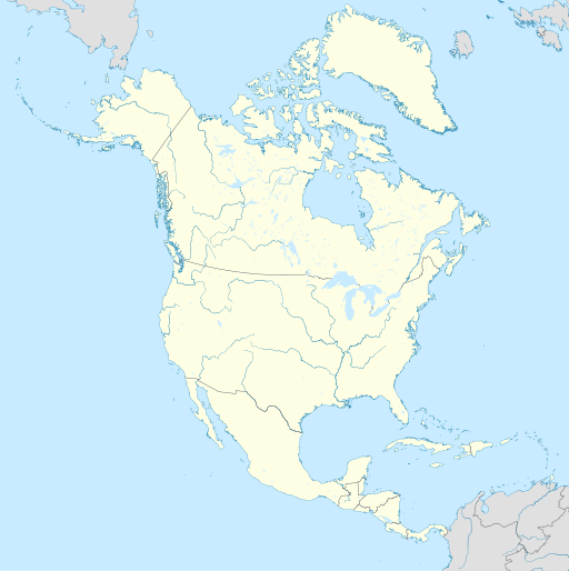
English: Location map of North America with national borders.
|
| Petsa | |
| Gigikanan | Kaugalingong trabaho |
| Tagsulat | Uwe Dedering |
| SVG genesis |
Pagtugot
I, the copyright holder of this work, hereby publish it under the following licenses:
This file is licensed under the Creative Commons Attribution-Share Alike 3.0 Unported license.
- Libre ka:
- sa pagsabwag – sa pagkopya, pag-apod-apod ug pagsabwag sa hinimo
- sa pag-remix – sa pag-adap sa binuhat
- Ubos sa mosunod nga mga kondisyon:
- atribusyon – Kinahanglan nimo nga hatagan ang angay nga kredito, maghatag usa ka link sa lisensya, ug ipakita kung adunay mga pagbag-o. Mahimo nimo kini buhaton sa bisan unsang makatarunganon nga paagi, apan dili sa bisan unsang paagi nga nagsugyot nga gi-endorso ka sa licensor o ang imong paggamit.
- share parehas – Kung imong gi-remix, gibag-o, o gibase sa materyal, kinahanglan nimo nga iapod-apod ang imong mga kontribusyon sa ilawom sa parehas o katugma nga lisensya sama sa orihinal.

|
Gitugot ang pagkopya, pag-apud-apod o/ug pag-usab ning maong dokumento ubos sa mga termino sa GNU Free Documentation License, Version 1.2 o mas bag-ong bersiyon nga gimantala sa Free Software Foundation; nga walay Invariant Sections, walay Front-Cover Texts, ug walay Back-Cover Texts. Ang kopya sa lisensiya gilakip sa bahin nga giulohang GNU Free Documentation License. |
You may select the license of your choice.
Kaagi sa payl
I-klik ang petsa/oras aron makit-an ang hulagway sa payl niadtong panahona.
| Petsa/Takna | Thumbnail | Mga dimensyon | Tiggamit | Komento | |
|---|---|---|---|---|---|
| kasamtangan | 16:22, 28 Oktubre 2017 | | 512 × 514 (1.96 MB) | JoKalliauer | made file valid |
| 10:38, 11 Disyembre 2014 |  | 1,181 × 1,185 (5.2 MB) | Ravenpuff | Minor alterations | |
| 00:27, 25 Oktubre 2014 |  | 1,181 × 1,185 (5.2 MB) | Ravenpuff | Minor alterations | |
| 13:13, 28 Nobiyembre 2010 |  | 1,181 × 1,185 (6.14 MB) | Uwe Dedering | {{Information |Description={{en|1= Location map of North America. * Projection: Lambert azimuthal equal-area projection. * Area of interest: :* N: 90.0° N :* S: 5.0° N :* W: -140.0° E :* E: -60.0° E * Projection center: :* NS: 47.5° N :* WE: -100.0° |
Mga paggamit sa payl
Ang mosunod nga 4 panid misumpay niining payl:
Global nga paggamit sa payl
Kining ubang wiki naggamit ning maong payl:
- Paggamit sa af.wikipedia.org
- Paggamit sa ar.wikipedia.org
- Paggamit sa ast.wikipedia.org
- Paggamit sa azb.wikipedia.org
- منهتن
- اوتاوا
- ویکتوریا، بریتیش کولومبیا
- واسیلا، آلاسکا
- سانتافه، نیومکزیکو
- لینکلن، نبراسکا
- تالاهاسی
- رالی، قوزئی کارولینا
- لنسینق، میشیقان
- مدیسن، ویسکانسین
- جفرسونسیتی
- جکسون، میسیسیپی
- باتونروژ، لوئیزیانا
- اولمپیا، واشینقتون
- سیلم، اورقن
- شابلون:Location map North America
- دوموزلار کؤرفزی عملیاتی
- آبویل، میسیسیپی
- آبینقدون، ویرجینیا
- آکسایدنت، مریلند
- آکتون، ماساچوست
- آدیسون، آلاباما
- آفتون، ویومینق
- آکرون، ایندیانا
- آکرون، میشیقان
- آلبانی، کالیفورنیا
- آلبیون، ایندیانا
- آلبیون، واشینقتون
- آلدرزون، اوکلاهوما
- آلدرزون، باتی ویرجینیا
- آلکساندریا، تنسی
- آلکساندریا، ویرجینیا
- آلفرد، مئین
- آلهامبرا، کالیفورنیا
- آلاین، اوکلاهوما
- آلیسو ویجو، کالیفورنیا
- آلن، گونئی داکوتا
- آلندئیل، میزوری
- آلنتوون، نیوجرسی
- آلموند، ویسکانسین
- آلتامونت، یوتا
- آلتونا، آلاباما
- آمریکان فورک، یوتا
- آمهرزت، نیوهمپشایر
- آمهرزت، ویرجینیا
View more global usage of this file.