Payl:Nottinghamshire UK locator map 2010.svg

Size of this PNG preview of this SVG file: 494 x 600 ka mga piksel. Uban pang mga resoluyon: 198 x 240 ka mga piksel | 395 x 480 ka mga piksel | 633 x 768 ka mga piksel | 843 x 1,024 ka mga piksel | 1,687 x 2,048 ka mga piksel | 1,108 x 1,345 ka mga piksel.
Tibuok resolusyon (SVG nga payl, nominally 1,108 × 1,345 pixels, size sa payl: 302 KB)
Mubong sugid:
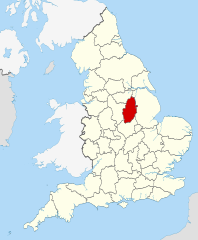
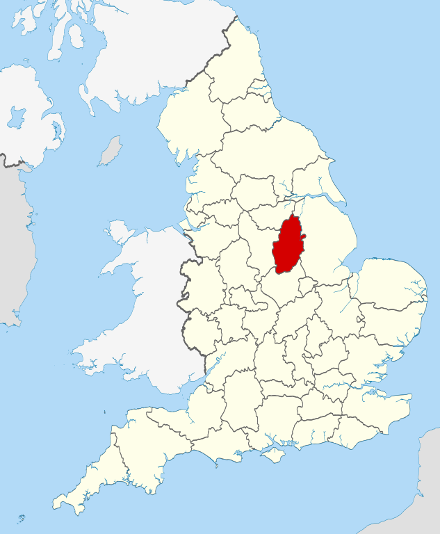
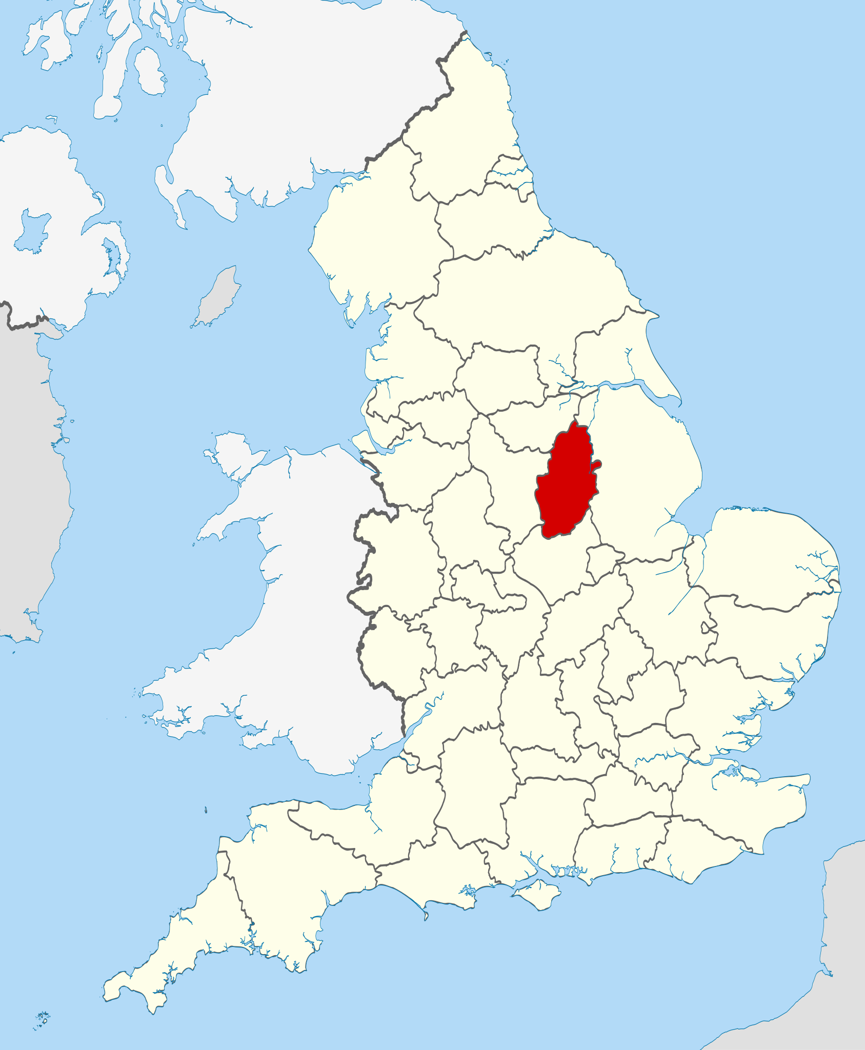
| Deskripsyon | Location of the ceremonial county of Nottinghamshire within England. |
| Petsa | |
| Gigikanan |
National Geospatial-Intelligence Agency
|
| Tagsulat | Nilfanion |
Pagtugot
I, the copyright holder of this work, hereby publish it under the following licenses:
This file is licensed under the Creative Commons Attribution-Share Alike 3.0 Unported license.
- Libre ka:
- sa pagsabwag – sa pagkopya, pag-apod-apod ug pagsabwag sa hinimo
- sa pag-remix – sa pag-adap sa binuhat
- Ubos sa mosunod nga mga kondisyon:
- atribusyon – Kinahanglan nimo nga hatagan ang angay nga kredito, maghatag usa ka link sa lisensya, ug ipakita kung adunay mga pagbag-o. Mahimo nimo kini buhaton sa bisan unsang makatarunganon nga paagi, apan dili sa bisan unsang paagi nga nagsugyot nga gi-endorso ka sa licensor o ang imong paggamit.
- share parehas – Kung imong gi-remix, gibag-o, o gibase sa materyal, kinahanglan nimo nga iapod-apod ang imong mga kontribusyon sa ilawom sa parehas o katugma nga lisensya sama sa orihinal.

|
Gitugot ang pagkopya, pag-apud-apod o/ug pag-usab ning maong dokumento ubos sa mga termino sa GNU Free Documentation License, Version 1.2 o mas bag-ong bersiyon nga gimantala sa Free Software Foundation; nga walay Invariant Sections, walay Front-Cover Texts, ug walay Back-Cover Texts. Ang kopya sa lisensiya gilakip sa bahin nga giulohang GNU Free Documentation License. |
You may select the license of your choice.

|
This is one of the images forming part of the Valued image set: Locator maps of the Ceremonial counties of England on Wikimedia Commons. The image set has been assessed under the valued image set criteria and is considered the most valued set on Commons within the scope:
Locator maps of the Ceremonial counties of England
You can see its nomination at Commons:Valued image candidates/Locator maps of English ceremonial counties. |
Kaagi sa payl
I-klik ang petsa/oras aron makit-an ang hulagway sa payl niadtong panahona.
| Petsa/Takna | Thumbnail | Mga dimensyon | Tiggamit | Komento | |
|---|---|---|---|---|---|
| kasamtangan | 22:42, 23 Nobiyembre 2010 | | 1,108 × 1,345 (302 KB) | Nilfanion | == Summary == {{Information |Description=Location of the ceremonial county of Nottinghamshire within England. |Source=Ordnance Survey [https://www.ordnancesurvey.co.uk/opendatadownload/products.html OpenData]: * |
Mga paggamit sa payl
Ang mosunod nga mga panid misumpay niining payl:
Global nga paggamit sa payl
Kining ubang wiki naggamit ning maong payl:
- Paggamit sa af.wikipedia.org
- Paggamit sa ar.wikipedia.org
- Paggamit sa arz.wikipedia.org
- Paggamit sa ast.wikipedia.org
- Paggamit sa be-tarask.wikipedia.org
- Paggamit sa be.wikipedia.org
- Paggamit sa bg.wikipedia.org
- Paggamit sa br.wikipedia.org
- Paggamit sa bs.wikipedia.org
- Paggamit sa ca.wikipedia.org
- Paggamit sa cs.wikipedia.org
- Paggamit sa dag.wikipedia.org
- Paggamit sa da.wikipedia.org
- Paggamit sa de.wikipedia.org
- Paggamit sa en.wikipedia.org
- Nottinghamshire
- University Farm (Nottinghamshire)
- Bircotes
- Manton, Nottinghamshire
- Soar Valley
- Redhill, Nottinghamshire
- Spion Kop, Nottinghamshire
- Ratcliffe-on-Soar
- Bunny, Nottinghamshire
- North Leverton with Habblesthorpe
- Adbolton
- Barton in Fabis
- Trent Lock
- Template:Nottinghamshire-geo-stub
- Wilford Hill
- Rhodesia, Nottinghamshire
- Meering
- Annesley
- Askham, Nottinghamshire
- Awsworth
- Barnby in the Willows
- Bathley
- Beckingham, Nottinghamshire
- Bestwood St. Albans
- Bevercotes
- Kneeton
- Beeston and Stapleford Urban District
- Bothamsall
- Bulcote
- Worksop Rural District
- Butler's Hill
- Westville, Nottinghamshire
- Thurgarton Wapentake
View more global usage of this file.