Payl:Oberstadt siegen.jpg
Gidak-on ning maong paunang tan-aw: 800 x 487 ka mga piksel. Uban pang mga resoluyon: 320 x 195 ka mga piksel | 640 x 390 ka mga piksel | 1,024 x 624 ka mga piksel | 1,589 x 968 ka mga piksel.
Tibuok resolusyon (1,589 × 968 pixels, size sa payl: 455 KB, MIME type: image/jpeg)
Mubong sugid:
| Deskripsyon |
|
| Petsa | (ISO 8601) |
| Gigikanan | self-made by author |
| Tagsulat | Bob Ionescu |
| Pagtugot (Paggamit pag-usab niini nga file) |
Deutsch: Dieses Bild ist urheberrechtlich geschützt. Der Urheber gestattet jedermann unter der Bedingung der angemessenen Nennung seiner Urheberschaft - Namensnennung (z.B. Foto: Bob Ionescu in der Bildunterschrift) jegliche Nutzung dieser Datei (Einräumung eines einfachen Nutzungsrechts). Weiterverbreitung, Bearbeitung und kommerzielle Nutzung sind gestattet. Der Verwender hat vor der Nutzung selbst zu prüfen, ob Rechte Dritter tangiert sind.
English: This image is copyrighted. The copyright holder allows anyone to use this file for any purpose (grant of a non-exclusive right to use), provided that the copyright holder is properly attributed (e.g. image: Bob Ionescu in the image caption). Redistribution, derivative work and commercial use is permitted. Before using, the user has to examine whether rights of third parties are concerned. |
| Other versions | For other images about the Oberstadt see Siegen. |
| Camera location | | View this and other nearby images on: OpenStreetMap |
|---|
Pagtugot

|
The copyright holder of this file allows anyone to use it for any purpose, provided that the copyright holder is properly attributed. Redistribution, derivative work, commercial use, and all other use is permitted. |
|
|
Kaagi sa payl
I-klik ang petsa/oras aron makit-an ang hulagway sa payl niadtong panahona.
| Petsa/Takna | Thumbnail | Mga dimensyon | Tiggamit | Komento | |
|---|---|---|---|---|---|
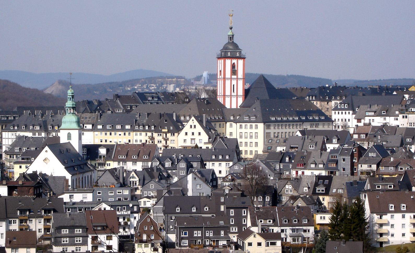
| kasamtangan | 08:36, 4 Abril 2005 | | 1,589 × 968 (455 KB) | Bob. | *Description: Blick auf die Oberstadt (Siegberg). Links ist die Marienkirche zu sehen, in der Mitte die Nikolaikirche mit dem Krönchen. Im Hintergrund sind die Gebäude der Universität sichtbar (Haardter Berg) *Aufgenommen am 16. März 2005 *Source: sel |
Mga paggamit sa payl
Ang mosunod nga mga panid misumpay niining payl:
Global nga paggamit sa payl
Kining ubang wiki naggamit ning maong payl:
- Paggamit sa af.wikipedia.org
- Paggamit sa ar.wikipedia.org
- Paggamit sa avk.wikipedia.org
- Paggamit sa azb.wikipedia.org
- Paggamit sa bg.wikipedia.org
- Paggamit sa cs.wikipedia.org
- Paggamit sa da.wikipedia.org
- Paggamit sa de.wikipedia.org
- Paggamit sa de.wikivoyage.org
- Paggamit sa en.wikipedia.org
- Paggamit sa en.wikivoyage.org
- Paggamit sa eo.wikipedia.org
- Paggamit sa es.wikipedia.org
- Paggamit sa et.wikipedia.org
- Paggamit sa eu.wikipedia.org
- Paggamit sa fa.wikipedia.org
- Paggamit sa fi.wikipedia.org
- Paggamit sa frr.wikipedia.org
- Paggamit sa fr.wikipedia.org
- Paggamit sa fy.wikipedia.org
- Paggamit sa he.wikipedia.org
- Paggamit sa hsb.wikipedia.org
- Paggamit sa ia.wikipedia.org
- Paggamit sa id.wikipedia.org
- Paggamit sa ie.wikipedia.org
- Paggamit sa incubator.wikimedia.org
- Paggamit sa is.wikipedia.org
- Paggamit sa ko.wikipedia.org
- Paggamit sa lb.wikipedia.org
- Paggamit sa lld.wikipedia.org
- Paggamit sa lmo.wikipedia.org
- Paggamit sa lt.wikipedia.org
- Paggamit sa lv.wikipedia.org
- Paggamit sa ms.wikipedia.org
- Paggamit sa mt.wikipedia.org
- Paggamit sa nl.wikipedia.org
- Paggamit sa oc.wikipedia.org
- Paggamit sa pl.wikipedia.org
- Paggamit sa pl.wikivoyage.org
- Paggamit sa pl.wiktionary.org
- Paggamit sa pnb.wikipedia.org
- Paggamit sa pt.wikipedia.org
- Paggamit sa ro.wikipedia.org
View more global usage of this file.