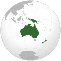
Payl:Oceania (orthographic projection).svg

Size of this PNG preview of this SVG file: 541 x 541 ka mga piksel. Uban pang mga resoluyon: 240 x 240 ka mga piksel | 480 x 480 ka mga piksel | 768 x 768 ka mga piksel | 1,024 x 1,024 ka mga piksel | 2,048 x 2,048 ka mga piksel.
Tibuok resolusyon (SVG nga payl, nominally 541 × 541 pixels, size sa payl: 63 KB)
Kaagi sa payl
I-klik ang petsa/oras aron makit-an ang hulagway sa payl niadtong panahona.
| Petsa/Takna | Thumbnail | Mga dimensyon | Tiggamit | Komento | |
|---|---|---|---|---|---|
| kasamtangan | 18:54, 6 Pebrero 2023 |  | 541 × 541 (63 KB) | Golden Mage | A change to the map of Asia will first face debate from others. Hence, a change to the commonly accepted map of Oceania cannot be made without a wider consensus. |
| 06:33, 6 Pebrero 2023 |  | 541 × 541 (108 KB) | Kwamikagami | rv: then perhaps we need to change the Asia map to match. This is as defined in WP. | |
| 18:19, 5 Pebrero 2023 |  | 541 × 541 (63 KB) | Golden Mage | Reverted to the map that displays the more accepted definition of Oceania's boundaries. Widely accepted geopolitical definitions take precedence over mere geographical ones. The map of the Wikipedia page for Asia already includes the Maluku Islands. | |
| 05:01, 5 Pebrero 2023 |  | 541 × 541 (108 KB) | Treetoes023 | Reverted to version as of 06:27, 24 December 2022 (UTC) | |
| 05:00, 5 Pebrero 2023 |  | 541 × 541 (63 KB) | Treetoes023 | Reverted to version as of 13:25, 31 December 2022 (UTC) | |
| 04:55, 5 Pebrero 2023 |  | 541 × 541 (108 KB) | Treetoes023 | Reverted to version as of 00:31, 4 December 2022 (UTC) | |
| 13:25, 31 Disyembre 2022 |  | 541 × 541 (63 KB) | Golden Mage | Reverted to the map that displays the more accepted definition of Oceania's boundaries. Widely accepted geopolitical definitions take precedence over mere geographical ones. | |
| 06:27, 24 Disyembre 2022 |  | 541 × 541 (108 KB) | Kwamikagami | Reverted to version as of 00:31, 4 December 2022 (UTC) definition per WP-en | |
| 06:13, 22 Disyembre 2022 |  | 541 × 541 (63 KB) | Golden Mage | Reverted to the map that displays the more accepted definition of Oceania's boundaries. | |
| 00:31, 4 Disyembre 2022 |  | 541 × 541 (108 KB) | Kwamikagami | the Weber line divides Oceanic from Asian Wallacea |
Mga paggamit sa payl
Ang mosunod nga 2 panid misumpay niining payl:
Global nga paggamit sa payl
Kining ubang wiki naggamit ning maong payl:
- Paggamit sa ab.wikipedia.org
- Paggamit sa ady.wikipedia.org
- Paggamit sa af.wikipedia.org
- Afrika
- Asië
- Europa
- Kiribati
- Noord-Amerika
- Suid-Amerika
- Vanuatu
- Guam
- Nieu-Seeland
- Sjabloon:Kontinente
- Australië
- Nauru
- Wellington, Nieu-Seeland
- Hoofstad
- Lys van hoofstede
- Sjabloon:Lande van Oseanië
- Honolulu
- Antarktika
- Gondwana
- Eurasië
- Laurasië
- Kategorie:Lande in Oseanië
- Lys van lande
- Fidji
- Canberra
- Hawaii
- Lys van nasionale leuses
- Clipperton
- Oseanië
- Norfolkeiland
- Amerikas
- Tonga
- Tuvalu
- Sjabloon:Hoofstede in Oseanië
- Palau
- Australië (kontinent)
- Afrika-Eurasië
- Samoa
- Marshalleilande
- Salomonseilande
- Papoea-Nieu-Guinee
- Gefedereerde State van Mikronesië
- Nukuʻalofa
- Port Moresby
- Apia
- Funafuti
- Honiara
- Majuro
View more global usage of this file.
