Payl:Ohio Portage Kent.png

Gidak-on ning maong paunang tan-aw: 800 x 468 ka mga piksel. Uban pang mga resoluyon: 320 x 187 ka mga piksel | 640 x 374 ka mga piksel | 1,025 x 599 ka mga piksel.
Tibuok resolusyon (1,025 × 599 pixels, size sa payl: 141 KB, MIME type: image/png)
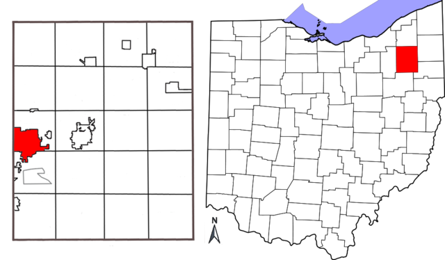
| Deskripsyon | Combination map showing location of Kent, Ohio within Portage County and Portage County's location within the state of Ohio. Original map of Ohio by David Benbennick; map of Portage County with Kent highlighted made by Jon Ridinger. |
| Petsa | (UTC) |
| Gigikanan | |
| Tagsulat |
| This is a retouched picture, which means that it has been digitally altered from its original version. Modifications: added two maps together; removed distance chart from Portage County map; moved compass. The original can be viewed here: Portage County Kent.png:
|
This file is licensed under the Creative Commons Attribution-Share Alike 3.0 Unported license.
- Libre ka:
- sa pagsabwag – sa pagkopya, pag-apod-apod ug pagsabwag sa hinimo
- sa pag-remix – sa pag-adap sa binuhat
- Ubos sa mosunod nga mga kondisyon:
- atribusyon – Kinahanglan nimo nga hatagan ang angay nga kredito, maghatag usa ka link sa lisensya, ug ipakita kung adunay mga pagbag-o. Mahimo nimo kini buhaton sa bisan unsang makatarunganon nga paagi, apan dili sa bisan unsang paagi nga nagsugyot nga gi-endorso ka sa licensor o ang imong paggamit.
- share parehas – Kung imong gi-remix, gibag-o, o gibase sa materyal, kinahanglan nimo nga iapod-apod ang imong mga kontribusyon sa ilawom sa parehas o katugma nga lisensya sama sa orihinal.
Original upload log
This image is a derivative work of the following images:
- File:Map_of_Ohio_highlighting_Portage_County.svg licensed with PD-self
- 2006-02-12T16:10:28Z David Benbennick 3675x3995 (59503 Bytes) {{subst:User:Dbenbenn/clm|county=Portage County|state=Ohio|type=county}}
- File:Portage_County_Kent.png licensed with Cc-by-3.0
- 2010-05-01T03:26:12Z JonRidinger 425x577 (81460 Bytes) Minor correction
- 2010-05-01T03:22:22Z JonRidinger 425x577 (76288 Bytes) Straightened map, cropped, removed extra white areas
- 2008-05-16T02:27:08Z JonRidinger 489x615 (44136 Bytes) {{Information |Description= Map of Portage County, Ohio with the city of Kent highlighted. |Source=self-made |Date= 15 May 2008 |Author= [[User:JonRidinger|JonRidinger]] |Permission= Public domain |other_versions= }} [[Categ
Uploaded with derivativeFX
Kaagi sa payl
I-klik ang petsa/oras aron makit-an ang hulagway sa payl niadtong panahona.
| Petsa/Takna | Thumbnail | Mga dimensyon | Tiggamit | Komento | |
|---|---|---|---|---|---|
| kasamtangan | 12:12, 7 Mayo 2010 | | 1,025 × 599 (141 KB) | JonRidinger | {{Information |Description=Combination map showing location of Kent, Ohio within Portage County and Portage County's location within the state of Ohio. Original map of Ohio by [[User:Dbenbenn|David B |
Mga paggamit sa payl
Ang mosunod nga mga panid misumpay niining payl:
Global nga paggamit sa payl
Kining ubang wiki naggamit ning maong payl:
- Paggamit sa ar.wikipedia.org
- Paggamit sa arz.wikipedia.org
- Paggamit sa azb.wikipedia.org
- Paggamit sa bn.wikipedia.org
- Paggamit sa ca.wikipedia.org
- Paggamit sa cy.wikipedia.org
- Paggamit sa en.wikipedia.org
- Paggamit sa eu.wikipedia.org
- Paggamit sa fa.wikipedia.org
- Paggamit sa fi.wikipedia.org
- Paggamit sa fr.wikipedia.org
- Paggamit sa ht.wikipedia.org
- Paggamit sa id.wikipedia.org
- Paggamit sa it.wikipedia.org
- Paggamit sa no.wikipedia.org
- Paggamit sa sh.wikipedia.org
- Paggamit sa sr.wikipedia.org
- Paggamit sa sv.wikipedia.org
- Paggamit sa tr.wikipedia.org
- Paggamit sa tt.wikipedia.org
- Paggamit sa ur.wikipedia.org
- Paggamit sa vo.wikipedia.org
- Paggamit sa www.wikidata.org
- Paggamit sa zh-min-nan.wikipedia.org
- Paggamit sa zh.wikipedia.org