Payl:Panauti.JPG

Gidak-on ning maong paunang tan-aw: 800 x 600 ka mga piksel. Uban pang mga resoluyon: 320 x 240 ka mga piksel | 640 x 480 ka mga piksel | 1,024 x 768 ka mga piksel | 1,280 x 960 ka mga piksel | 2,560 x 1,920 ka mga piksel | 3,264 x 2,448 ka mga piksel.
Tibuok resolusyon (3,264 × 2,448 pixels, size sa payl: 2.3 MB, MIME type: image/jpeg)
Mubong sugid:
| Deskripsyon |
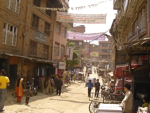
English: Looking south along a street in Panauti, Nepal just south of the bus station area. Altitude 1440 meters. |
||
| Petsa | |||
| Gigikanan | Kaugalingong trabaho | ||
| Tagsulat | Brian Dell | ||
| Pagtugot (Paggamit pag-usab niini nga file) |
|
| Camera location | | View this and other nearby images on: OpenStreetMap |
|---|
Kaagi sa payl
I-klik ang petsa/oras aron makit-an ang hulagway sa payl niadtong panahona.
| Petsa/Takna | Thumbnail | Mga dimensyon | Tiggamit | Komento | |
|---|---|---|---|---|---|
| kasamtangan | 05:54, 9 Agosto 2010 | | 3,264 × 2,448 (2.3 MB) | Bdell555 | {{Information |Description={{en|1=Looking south along a street in Panauti, Nepal just south of the bus station area. Altitude 1440 meters.}} |Source={{own}} |Author=Brian Dell Bdell555 |Date=2010-04-10 |Permission= |other_ |
Mga paggamit sa payl
Ang mosunod nga 2 panid misumpay niining payl:
Global nga paggamit sa payl
Kining ubang wiki naggamit ning maong payl:
- Paggamit sa de.wikipedia.org
- Paggamit sa en.wikipedia.org
- Paggamit sa eo.wikipedia.org
- Paggamit sa fa.wikipedia.org
- Paggamit sa ku.wikipedia.org
- Paggamit sa mai.wikipedia.org
- Paggamit sa pl.wikipedia.org
- Paggamit sa ru.wikipedia.org
- Paggamit sa ur.wikipedia.org
- Paggamit sa www.wikidata.org
- Paggamit sa zh.wikipedia.org