Payl:Picardie region location map.svg

Size of this PNG preview of this SVG file: 794 x 600 ka mga piksel. Uban pang mga resoluyon: 318 x 240 ka mga piksel | 636 x 480 ka mga piksel | 1,017 x 768 ka mga piksel | 1,280 x 967 ka mga piksel | 2,560 x 1,933 ka mga piksel | 1,842 x 1,391 ka mga piksel.
Tibuok resolusyon (SVG nga payl, nominally 1,842 × 1,391 pixels, size sa payl: 446 KB)
Mubong sugid:
| Camera location | | View this and other nearby images on: OpenStreetMap |
|---|
| Deskripsyon |
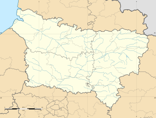
Français : Carte administrative vierge de la département de la Picardie, France, destinée à la géolocalisation.
|
| Petsa | |
| Gigikanan |
Kaugalingong trabaho |
| Tagsulat | User:Bourrichon - fr:Bourrichon) |
| Other versions |
|

Pagtugot
I, the copyright holder of this work, hereby publish it under the following licenses:
This file is licensed under the Creative Commons Attribution-Share Alike 3.0 Unported license.
- Libre ka:
- sa pagsabwag – sa pagkopya, pag-apod-apod ug pagsabwag sa hinimo
- sa pag-remix – sa pag-adap sa binuhat
- Ubos sa mosunod nga mga kondisyon:
- atribusyon – Kinahanglan nimo nga hatagan ang angay nga kredito, maghatag usa ka link sa lisensya, ug ipakita kung adunay mga pagbag-o. Mahimo nimo kini buhaton sa bisan unsang makatarunganon nga paagi, apan dili sa bisan unsang paagi nga nagsugyot nga gi-endorso ka sa licensor o ang imong paggamit.
- share parehas – Kung imong gi-remix, gibag-o, o gibase sa materyal, kinahanglan nimo nga iapod-apod ang imong mga kontribusyon sa ilawom sa parehas o katugma nga lisensya sama sa orihinal.

|
Gitugot ang pagkopya, pag-apud-apod o/ug pag-usab ning maong dokumento ubos sa mga termino sa GNU Free Documentation License, Version 1.2 o mas bag-ong bersiyon nga gimantala sa Free Software Foundation; nga walay Invariant Sections, walay Front-Cover Texts, ug walay Back-Cover Texts. Ang kopya sa lisensiya gilakip sa bahin nga giulohang GNU Free Documentation License. |
You may select the license of your choice.
Kaagi sa payl
I-klik ang petsa/oras aron makit-an ang hulagway sa payl niadtong panahona.
| Petsa/Takna | Thumbnail | Mga dimensyon | Tiggamit | Komento | |
|---|---|---|---|---|---|
| kasamtangan | 15:51, 11 Nobiyembre 2012 | | 1,842 × 1,391 (446 KB) | Bourrichon | stretch |
| 13:50, 11 Nobiyembre 2012 |  | 1,842 × 1,242 (447 KB) | Bourrichon | == {{int:filedesc}} == {{Location|50|00|00|N|03|00|00|E|scale:3000000}} <br/> {{Information |Description={{fr|Carte administrative vierge de la département de la fr:Picardie (région), France, destinée ... |
Mga paggamit sa payl
Ang mosunod nga 2 panid misumpay niining payl:
Global nga paggamit sa payl
Kining ubang wiki naggamit ning maong payl:
- Paggamit sa ar.wikipedia.org
- Paggamit sa bg.wikipedia.org
- Paggamit sa de.wikipedia.org
- Paggamit sa el.wikipedia.org
- Paggamit sa en.wikipedia.org
- Paggamit sa eo.wikipedia.org
- Paggamit sa es.wikipedia.org
- Paggamit sa fa.wikipedia.org
- Paggamit sa fo.wikipedia.org
- Paggamit sa fr.wikipedia.org
- Parc Astérix
- Amiens Sporting Club
- Portail:Picardie
- Stade de la Licorne
- Sporting Club abbevillois Foot Côte picarde
- Hippodrome du Petit-Saint-Jean
- Liste des commanderies templières en Picardie
- Coliseum
- Utilisateur:Wrangel/brouillon
- Centre pénitentiaire de Château-Thierry
- Cité des bateliers
- Parc Saint-Paul
- Centre pénitentiaire de Liancourt
- Château de Boves
- Commanderie de Boncourt
- Projet:Cartographie/Cartes standards/France
- Viaduc de l'Avre
- Viaduc du Scardon
- Stade Pierre-Brisson
- Golf de Compiègne
- Golf de Morfontaine
- Golf de Chantilly
- Modèle:Géolocalisation/Picardie
- Modèle:Géolocdual/Picardie
- Stade André-Coël
- Modèle:Carte/Picardie
View more global usage of this file.