Payl:Pine Valley Mountain from Lower Sand Cove at dusk 2009-06-10.jpg

Gidak-on ning maong paunang tan-aw: 800 x 600 ka mga piksel. Uban pang mga resoluyon: 320 x 240 ka mga piksel | 640 x 480 ka mga piksel | 1,024 x 768 ka mga piksel | 1,280 x 960 ka mga piksel | 2,592 x 1,944 ka mga piksel.
Tibuok resolusyon (2,592 × 1,944 pixels, size sa payl: 1,003 KB, MIME type: image/jpeg)
Mubong sugid:
| Deskripsyon |
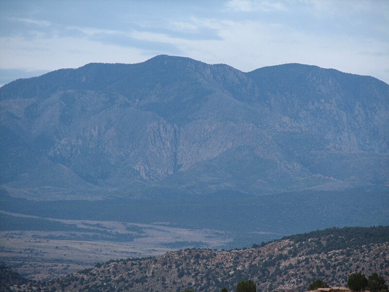
English: Photo of Pine Valley Mountain in Washington County, Utah, USA. The left-most peak is Burger Peak (10,321' elevation) and the right-most is Signal Peak (10,365' elevation). |
| Petsa | |
| Gigikanan | Kaugalingong trabaho |
| Tagsulat | Zettabyte |
| Camera location | | View this and other nearby images on: OpenStreetMap |
|---|
Taken at dusk from the Red Mountain Wilderness Study Area in the slickrock area south of Lower Sand Cove Reservoir.
Pagtugot
I, the copyright holder of this work, hereby publish it under the following license:
This file is licensed under the Creative Commons Attribution 3.0 Unported license.
- Libre ka:
- sa pagsabwag – sa pagkopya, pag-apod-apod ug pagsabwag sa hinimo
- sa pag-remix – sa pag-adap sa binuhat
- Ubos sa mosunod nga mga kondisyon:
- atribusyon – Kinahanglan nimo nga hatagan ang angay nga kredito, maghatag usa ka link sa lisensya, ug ipakita kung adunay mga pagbag-o. Mahimo nimo kini buhaton sa bisan unsang makatarunganon nga paagi, apan dili sa bisan unsang paagi nga nagsugyot nga gi-endorso ka sa licensor o ang imong paggamit.
Kaagi sa payl
I-klik ang petsa/oras aron makit-an ang hulagway sa payl niadtong panahona.
| Petsa/Takna | Thumbnail | Mga dimensyon | Tiggamit | Komento | |
|---|---|---|---|---|---|
| kasamtangan | 23:08, 19 Disyembre 2011 | | 2,592 × 1,944 (1,003 KB) | Centpacrr | Reverted to version as of 21:47, 13 June 2009 (I now see that alteration request was not made by the original uploader) |
| 22:50, 19 Disyembre 2011 |  | 2,592 × 1,944 (1.09 MB) | Centpacrr | New version | |
| 22:07, 19 Disyembre 2011 |  | 2,592 × 1,944 (1,003 KB) | Jbarta | Reverted to version as of 21:47, 13 June 2009 - Are you serious? | |
| 22:02, 19 Disyembre 2011 |  | 2,592 × 1,944 (4.38 MB) | Centpacrr | Adjusted as requested. | |
| 21:47, 13 Hunyo 2009 |  | 2,592 × 1,944 (1,003 KB) | Zettabyte | Attempted to add geolocation exif data. | |
| 21:38, 13 Hunyo 2009 |  | 2,592 × 1,944 (1,003 KB) | Zettabyte | {{Information |Description={{en|1=Photo of Pine Valley Mountain in Washington County, Utah, USA. The left-most peak is Burger Peak (10,321' elevation) and the right-most is Signal Peak (10,365' elevation).}} |Source=Own work by uploader |Author=[[User:Zet |
Mga paggamit sa payl
Ang mosunod nga mga panid misumpay niining payl:
Global nga paggamit sa payl
Kining ubang wiki naggamit ning maong payl:
- Paggamit sa arz.wikipedia.org
- Paggamit sa en.wikipedia.org
- Paggamit sa lld.wikipedia.org
- Paggamit sa www.wikidata.org