Payl:Qatar location map.svg

Size of this PNG preview of this SVG file: 631 x 599 ka mga piksel. Uban pang mga resoluyon: 253 x 240 ka mga piksel | 505 x 480 ka mga piksel | 808 x 768 ka mga piksel | 1,078 x 1,024 ka mga piksel | 2,156 x 2,048 ka mga piksel | 1,039 x 987 ka mga piksel.
Tibuok resolusyon (SVG nga payl, nominally 1,039 × 987 pixels, size sa payl: 60 KB)
Mubong sugid:
| Deskripsyon |
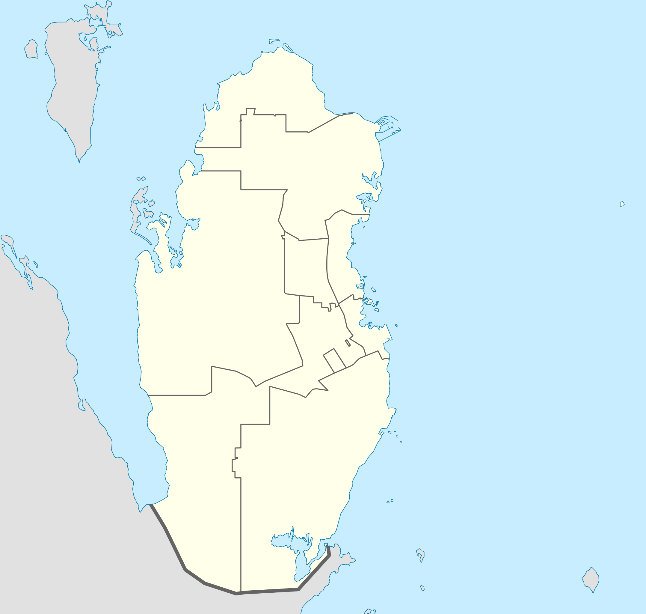
Deutsch: Positionskarte von Katar
Quadratische Plattkarte, N-S-Streckung 110 %. Geographische Begrenzung der Karte:
English: Location map of Qatar
Equirectangular projection, N/S stretching 110 %. Geographic limits of the map:
|
| Petsa | |
| Gigikanan |
own work, using
|
| Tagsulat | NordNordWest |

|
This map has been made or improved in the German Kartenwerkstatt (Map Lab). You can propose maps to improve as well.
|
Pagtugot
I, the copyright holder of this work, hereby publish it under the following licenses:

|
Gitugot ang pagkopya, pag-apud-apod o/ug pag-usab ning maong dokumento ubos sa mga termino sa GNU Free Documentation License, Version 1.2 o mas bag-ong bersiyon nga gimantala sa Free Software Foundation; nga walay Invariant Sections, walay Front-Cover Texts, ug walay Back-Cover Texts. Ang kopya sa lisensiya gilakip sa bahin nga giulohang GNU Free Documentation License. |
This file is licensed under the Creative Commons Attribution-Share Alike 3.0 Unported license.
- Libre ka:
- sa pagsabwag – sa pagkopya, pag-apod-apod ug pagsabwag sa hinimo
- sa pag-remix – sa pag-adap sa binuhat
- Ubos sa mosunod nga mga kondisyon:
- atribusyon – Kinahanglan nimo nga hatagan ang angay nga kredito, maghatag usa ka link sa lisensya, ug ipakita kung adunay mga pagbag-o. Mahimo nimo kini buhaton sa bisan unsang makatarunganon nga paagi, apan dili sa bisan unsang paagi nga nagsugyot nga gi-endorso ka sa licensor o ang imong paggamit.
- share parehas – Kung imong gi-remix, gibag-o, o gibase sa materyal, kinahanglan nimo nga iapod-apod ang imong mga kontribusyon sa ilawom sa parehas o katugma nga lisensya sama sa orihinal.
You may select the license of your choice.
Kaagi sa payl
I-klik ang petsa/oras aron makit-an ang hulagway sa payl niadtong panahona.
| Petsa/Takna | Thumbnail | Mga dimensyon | Tiggamit | Komento | |
|---|---|---|---|---|---|
| kasamtangan | 23:02, 24 Mayo 2022 | | 1,039 × 987 (60 KB) | Spesh531 | updating internal borders and Qatar-Saudi Arabia border |
| 21:11, 9 Enero 2011 |  | 1,039 × 987 (50 KB) | NordNordWest | upd | |
| 17:31, 19 Disyembre 2009 |  | 1,039 × 988 (77 KB) | NordNordWest | update | |
| 21:22, 24 Agosto 2008 |  | 1,039 × 988 (73 KB) | NordNordWest | {{Information |Description= {{de|Positionskarte von Katar}} Quadratische Plattkarte, N-S-Streckung 110 %. Geographische Begrenzung der Karte: * N: 26.3° N * S: 24.4° N * W: 50.3° O * O: 52.5° O {{en|Location map of Qatar}} |
Mga paggamit sa payl
More than 100 pages use this file. The following list shows the first 100 pages that use this file only. A full list is available.
- Abū Fushayghah
- Abū Ghamīlah
- Abū Samrah
- Abū Sidrah
- Abū ar Rīsh
- Ad Dawḩah
- Al-Khaur
- Al Bahath
- Al Far‘
- Al Hashamīyah
- Al Jasrah
- Al Jubayl
- Al Kharrārah
- Al Khathiyah
- Al Khawr
- Al Khor
- Al Maqrūn
- Al Maqārīn
- Al Qarn
- Al Qatar
- Al Qulay‘ah
- Al Wakrah
- Al ‘Uwaynāt
- Ar Rayyān
- Ar Ruways
- Ar Ru’ays
- As Sīq
- Ash Shaḩānīyah
- At Tawilah
- Aş Şubayḩah
- Aţ Ţawīlah
- Brook
- Burq al Khufūs
- Dawḩat Zikrīt
- Doha
- Dukhān
- Fadihah
- Fasht ad Dībal
- Hazm Sauda Nathil
- Jabal Fuwayriţ
- Jafn aḑ Ḑabb
- Jarī aş Şaḩrā
- Jaww as Salāmah
- Jaww as Salāmah (libaong sa Katar)
- Jazīrat Ḩawār
- Katar (pagklaro)
- Khawr Shaqīq
- Khor
- Lach
- Madīnat ash Shamāl
- Mamlaḩah
- Mulayḩ
- Musay‘īd
- Qaryāt al ‘Aţan
- Qatar (pagklaro)
- Qaţar
- Ra's al Maţbakh
- Ra's al Qaşāşīr
- Ra's al Ḩusayn
- Raiyan
- Rawḑat Abrūq
- Rawḑat al Faras
- Rawḑān
- Ra’s Laffān
- Ra’s al Jabal
- Ra’s al Maţbakh
- Ra’s al Qaşāşīr
- Ra’s al Ḩusayn
- Ra’s ‘Ushayrij
- Ruwais
- Sabkhat Sawdā' Nathīl
- Sadri
- Saja
- Salamiyah
- Sidrī
- South Mesa
- Umm Bāb
- Umm al Adham
- Umm al Ghirbān
- Umm al Jarāthīm
- Umm al ‘Iz̧ām
- Umm ar Ru’ūs
- Umm ‘Unayq
- Wadi Raghwan
- Wadi ar Rashidi
- Waqbat al Maşyaf
- Wādī Raghwān
- Wādī adh Dhi’āb
- Wādī al Ghirbān
- Wādī ath Thumām
- Zikrīt
- أم عنيق
- الخور
- الرويس
- السيق
- الفرع
- اَلْخُوَيْمَات
- وادي السيق
- Ḩazm al ‘Arād
- ‘Amrān
View more links to this file.
Global nga paggamit sa payl
Kining ubang wiki naggamit ning maong payl:
- Paggamit sa af.wikipedia.org
- Paggamit sa ar.wikipedia.org
- كأس الخليج العربي 4
- كأس العالم 2022
- كأس آسيا 2011
- قالب:خريطة مواقع قطر
- بطولة العالم لكرة اليد للرجال 2015
- بطولة آسيا تحت 23 سنة لكرة القدم 2016
- كأس الخليج للمنتخبات الأولمبية 2010
- محطة رأس لفان للطاقة
- بطولة الأندية العربية لأبطال الدوري 2001
- كأس القارات لكرة الصالات 2016
- دوري نجوم قطر 2009–10
- دوري نجوم قطر 2010–11
- دوري نجوم قطر 2011–12
- دوري نجوم قطر 2013–14
- دوري نجوم قطر 2014–15
- دوري نجوم قطر 2015–16
- كأس الخليج العربي 24
- كأس العالم للأندية 2019
- كأس العالم للأندية 2020
- كأس العرب 2021
- تصفيات كأس العرب 2021
- كأس سوبر لوسيل 2022
- كأس آسيا تحت 23 سنة 2024
- ملاعب كأس العالم 2022
- Paggamit sa ast.wikipedia.org
- Paggamit sa ba.wikipedia.org
- Paggamit sa be-tarask.wikipedia.org
- Paggamit sa be.wikipedia.org
- Paggamit sa bg.wikipedia.org
- Paggamit sa bn.wikipedia.org
- Paggamit sa bs.wikipedia.org
View more global usage of this file.