Payl:Saarland location map 02.svg

Size of this PNG preview of this SVG file: 658 x 540 ka mga piksel. Uban pang mga resoluyon: 293 x 240 ka mga piksel | 585 x 480 ka mga piksel | 936 x 768 ka mga piksel | 1,248 x 1,024 ka mga piksel | 2,496 x 2,048 ka mga piksel.
Tibuok resolusyon (SVG nga payl, nominally 658 × 540 pixels, size sa payl: 125 KB)
Mubong sugid:
| Deskripsyon |
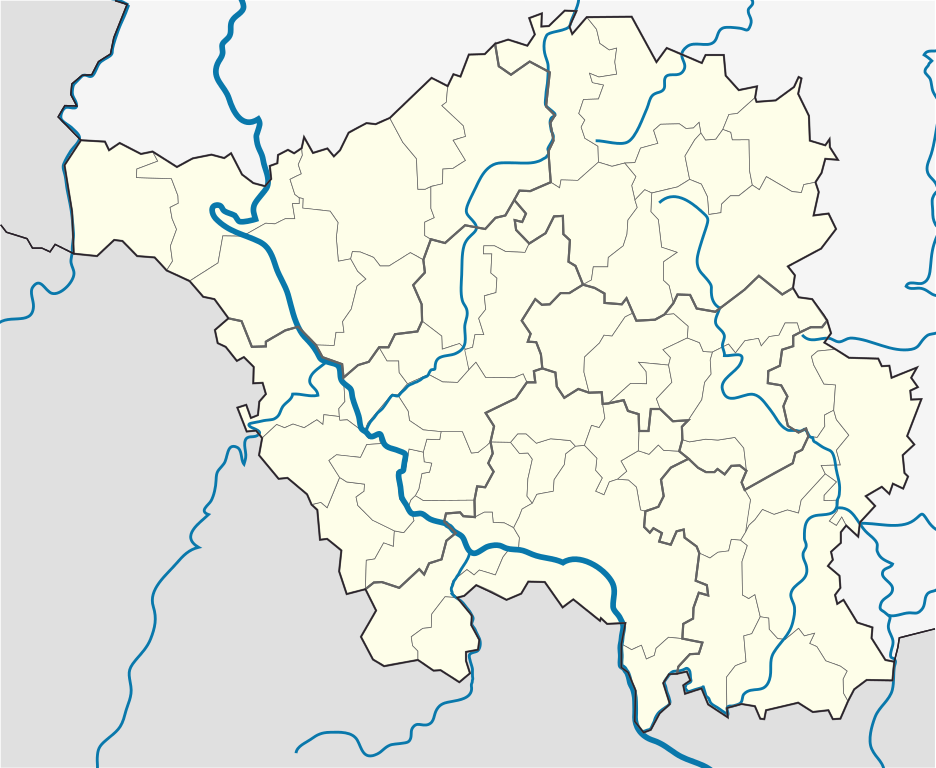
English: Position map of the state of Saarland with the six disticts and fiftytwo municipalities
Geographic limits of the map: * N: 49.65° N * S: 49.09° N * W: 6.3° E * E: 7.405° E Deutsch: Positionskarte vom Bundesland Saarland mit seinen sechs Kreisen und 52 Gemeinden Quadratische Plattkarte. Geographische Begrenzung der Karte: * N: 49.65° N * S: 49.09° N * W: 6.3° E * E: 7.405° E |
| Petsa | |
| Gigikanan |
Kaugalingong trabaho, based on: |
| Tagsulat |
TUBS |
| Other versions |
 |
Pagtugot
I, the copyright holder of this work, hereby publish it under the following license:
This file is licensed under the Creative Commons Attribution-Share Alike 3.0 Unported license.
- Libre ka:
- sa pagsabwag – sa pagkopya, pag-apod-apod ug pagsabwag sa hinimo
- sa pag-remix – sa pag-adap sa binuhat
- Ubos sa mosunod nga mga kondisyon:
- atribusyon – Kinahanglan nimo nga hatagan ang angay nga kredito, maghatag usa ka link sa lisensya, ug ipakita kung adunay mga pagbag-o. Mahimo nimo kini buhaton sa bisan unsang makatarunganon nga paagi, apan dili sa bisan unsang paagi nga nagsugyot nga gi-endorso ka sa licensor o ang imong paggamit.
- share parehas – Kung imong gi-remix, gibag-o, o gibase sa materyal, kinahanglan nimo nga iapod-apod ang imong mga kontribusyon sa ilawom sa parehas o katugma nga lisensya sama sa orihinal.
Kaagi sa payl
I-klik ang petsa/oras aron makit-an ang hulagway sa payl niadtong panahona.
| Petsa/Takna | Thumbnail | Mga dimensyon | Tiggamit | Komento | |
|---|---|---|---|---|---|
| kasamtangan | 15:09, 22 Marso 2010 | | 658 × 540 (125 KB) | TUBS | == {{int:filedesc}} == {{Information |Description={{en|1=Position map of the state of Saarland with the six disticts and fiftytwo municipalities<br> Geographic limits of the map: * N: 49.65° N * S: 49.09° N * W: 6.3° E * E: 7.405° E}} {{de|1=Positions |
Mga paggamit sa payl
Ang mosunod nga mga panid misumpay niining payl:
Global nga paggamit sa payl
Kining ubang wiki naggamit ning maong payl:
- Paggamit sa ar.wikipedia.org
- Paggamit sa dsb.wikipedia.org
- Paggamit sa en.wikipedia.org
- Saarbrücken
- Wallerfangen
- Saarlouis
- Lebach
- Saarwellingen
- Sankt Wendel
- Heusweiler
- Überherrn
- Weiskirchen
- Homburg, Saarland
- Wadern
- Dillingen, Saarland
- Dudweiler
- Sankt Ingbert
- Merzig
- Beckingen
- Losheim am See
- Mettlach
- Perl, Saarland
- Neunkirchen, Saarland
- Ottweiler
- Eppelborn
- Illingen, Saarland
- Merchweiler
- Schiffweiler
- Spiesen-Elversberg
- Bous, Germany
- Schwalbach, Saarland
- Ensdorf, Saarland
- Nalbach
- Rehlingen-Siersburg
- Schmelz
- Wadgassen
- Friedrichsthal
- Püttlingen
- Sulzbach, Saarland
- Völklingen
- Großrosseln
- Kleinblittersdorf
- Quierschied
- Riegelsberg
- Bexbach
- Blieskastel
- Gersheim
- Kirkel
- Mandelbachtal
- Freisen
- Marpingen
View more global usage of this file.