Payl:Santa Cruz County Incorporated and Unincorporated areas Nogales highlighted.svg

Size of this PNG preview of this SVG file: 800 x 424 ka mga piksel. Uban pang mga resoluyon: 320 x 169 ka mga piksel | 640 x 339 ka mga piksel | 1,024 x 542 ka mga piksel | 1,280 x 678 ka mga piksel | 2,560 x 1,355 ka mga piksel | 850 x 450 ka mga piksel.
Tibuok resolusyon (SVG nga payl, nominally 850 × 450 pixels, size sa payl: 41 KB)
Mubong sugid:
| Deskripsyon |
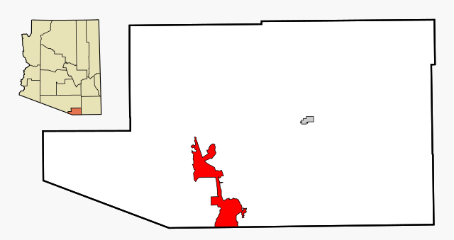
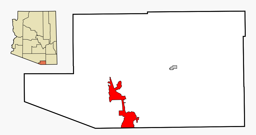
This map shows the incorporated areas and unincorporated areas in Santa Cruz County, Arizona.
|
| Petsa | |
| Gigikanan | My own work, based on public domain information |
| Tagsulat | Ixnayonthetimmay |
| Pagtugot (Paggamit pag-usab niini nga file) |
All rights not reserved. See below. |
| Other versions | See Category:Maps of Santa Cruz County for other versions of this image. |
Pagtugot
| I, the copyright holder of this work, release this work into the public domain. This applies worldwide. In some countries this may not be legally possible; if so: I grant anyone the right to use this work for any purpose, without any conditions, unless such conditions are required by law. |
Kaagi sa payl
I-klik ang petsa/oras aron makit-an ang hulagway sa payl niadtong panahona.
| Petsa/Takna | Thumbnail | Mga dimensyon | Tiggamit | Komento | |
|---|---|---|---|---|---|
| kasamtangan | 02:55, 3 Marso 2007 | | 850 × 450 (41 KB) | Ixnayonthetimmay | {{Information |Description=This map shows the incorporated areas and unincorporated areas in Santa Cruz County, Arizona. Nogales i |
Mga paggamit sa payl
Ang mosunod nga mga panid misumpay niining payl:
Global nga paggamit sa payl
Kining ubang wiki naggamit ning maong payl:
- Paggamit sa ar.wikipedia.org
- Paggamit sa arz.wikipedia.org
- Paggamit sa ca.wikipedia.org
- Paggamit sa cy.wikipedia.org
- Paggamit sa eu.wikipedia.org
- Paggamit sa fa.wikipedia.org
- Paggamit sa fr.wikipedia.org
- Paggamit sa ht.wikipedia.org
- Paggamit sa hu.wikipedia.org
- Paggamit sa id.wikipedia.org
- Paggamit sa ps.wikipedia.org
- Paggamit sa pt.wikipedia.org
- Paggamit sa ro.wikipedia.org
- Paggamit sa sr.wikipedia.org
- Paggamit sa sv.wikipedia.org
- Paggamit sa tt.wikipedia.org
- Paggamit sa vo.wikipedia.org
- Paggamit sa www.wikidata.org
- Paggamit sa zh-min-nan.wikipedia.org