Payl:St Marys Church Rimswell.jpg
Walay mas taas nga resolusyon.
St_Marys_Church_Rimswell.jpg (640 × 480 pixels, size sa payl: 118 KB, MIME type: image/jpeg)
This is a photo of listed building number 1083462. |
Mubong sugid:
| Deskripsyon |
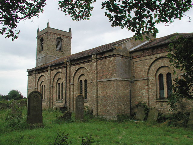
English: St Mary's parish church, Rimswell, East Riding of Yorkshire, England, seen from the southeast. The church is not currently used for worship. Between about 1790 and 1840, corpses were reputedly exhumed from the nearby village of Owthorne and reburied in St Mary's churchyard, as much of the village of Owthorne was being lost to coastal erosion. |
| Petsa | |
| Gigikanan | From geograph.org.uk |
| Tagsulat | Paul Glazzard |
| Pagtugot (Paggamit pag-usab niini nga file) |
Creative Commons Attribution Share-alike license 2.0 |
| Attribution (required by the license) | Paul Glazzard / St. Mary's Church, Rimswell / |
| Camera location | | View this and other nearby images on: OpenStreetMap |
|---|
_heading:292.00&language=ceb)
| Object location | | View this and other nearby images on: OpenStreetMap |
|---|
_heading:292.00&language=ceb)
Pagtugot

|
This image was taken from the Geograph project collection. See this photograph's page on the Geograph website for the photographer's contact details. The copyright on this image is owned by Paul Glazzard and is licensed for reuse under the Creative Commons Attribution-ShareAlike 2.0 license.
|
This file is licensed under the Creative Commons Attribution-Share Alike 2.0 Generic license.
Attribution: Paul Glazzard
- Libre ka:
- sa pagsabwag – sa pagkopya, pag-apod-apod ug pagsabwag sa hinimo
- sa pag-remix – sa pag-adap sa binuhat
- Ubos sa mosunod nga mga kondisyon:
- atribusyon – Kinahanglan nimo nga hatagan ang angay nga kredito, maghatag usa ka link sa lisensya, ug ipakita kung adunay mga pagbag-o. Mahimo nimo kini buhaton sa bisan unsang makatarunganon nga paagi, apan dili sa bisan unsang paagi nga nagsugyot nga gi-endorso ka sa licensor o ang imong paggamit.
- share parehas – Kung imong gi-remix, gibag-o, o gibase sa materyal, kinahanglan nimo nga iapod-apod ang imong mga kontribusyon sa ilawom sa parehas o katugma nga lisensya sama sa orihinal.
Kaagi sa payl
I-klik ang petsa/oras aron makit-an ang hulagway sa payl niadtong panahona.
| Petsa/Takna | Thumbnail | Mga dimensyon | Tiggamit | Komento | |
|---|---|---|---|---|---|
| kasamtangan | 00:31, 7 Pebrero 2008 | | 640 × 480 (118 KB) | Keith D | {{Information |Description=St Mary's Church, Rimswell in the East Riding of Yorkshire |Source=Geograph project http://www.geograph.org.uk/photo/190706 |Date=Friday, 23 June, 2006 |Author=Paul Glazzard |Pe |
Mga paggamit sa payl
Ang mosunod nga mga panid misumpay niining payl:
Global nga paggamit sa payl
Kining ubang wiki naggamit ning maong payl:
- Paggamit sa ang.wikipedia.org
- Paggamit sa en.wikipedia.org
- Paggamit sa fa.wikipedia.org
- Paggamit sa fr.wikipedia.org
- Paggamit sa it.wikipedia.org
- Paggamit sa lld.wikipedia.org
- Paggamit sa nl.wikipedia.org
- Paggamit sa pl.wikipedia.org
- Paggamit sa www.wikidata.org