Payl:Taiwan location map.svg

Size of this PNG preview of this SVG file: 499 x 600 ka mga piksel. Uban pang mga resoluyon: 200 x 240 ka mga piksel | 399 x 480 ka mga piksel | 639 x 768 ka mga piksel | 852 x 1,024 ka mga piksel | 1,704 x 2,048 ka mga piksel | 1,016 x 1,221 ka mga piksel.
Tibuok resolusyon (SVG nga payl, nominally 1,016 × 1,221 pixels, size sa payl: 121 KB)

|
This file requires updating. In doing so, you could add a timestamp to the file.
|

|
The boundaries on this map show the de facto situation. This is just one of several different views on the subject (see COM:NPOV). |
Mubong sugid:
| Deskripsyon |
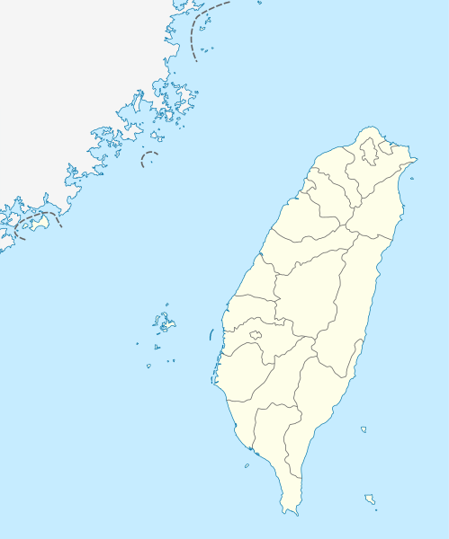
Quadratische Plattkarte, N-S-Streckung 110 %. Geographische Begrenzung der Karte:
Equirectangular projection, N/S stretching 110 %. Geographic limits of the map:
|
| Petsa | |
| Gigikanan | own work, using United States National Imagery and Mapping Agency data |
| Tagsulat | NordNordWest |

|
This map has been made or improved in the German Kartenwerkstatt (Map Lab). You can propose maps to improve as well.
|
Pagtugot
I, the copyright holder of this work, hereby publish it under the following licenses:

|
Gitugot ang pagkopya, pag-apud-apod o/ug pag-usab ning maong dokumento ubos sa mga termino sa GNU Free Documentation License, Version 1.2 o mas bag-ong bersiyon nga gimantala sa Free Software Foundation; nga walay Invariant Sections, walay Front-Cover Texts, ug walay Back-Cover Texts. Ang kopya sa lisensiya gilakip sa bahin nga giulohang GNU Free Documentation License. |
This file is licensed under the Creative Commons Attribution-Share Alike 3.0 Unported license.
- Libre ka:
- sa pagsabwag – sa pagkopya, pag-apod-apod ug pagsabwag sa hinimo
- sa pag-remix – sa pag-adap sa binuhat
- Ubos sa mosunod nga mga kondisyon:
- atribusyon – Kinahanglan nimo nga hatagan ang angay nga kredito, maghatag usa ka link sa lisensya, ug ipakita kung adunay mga pagbag-o. Mahimo nimo kini buhaton sa bisan unsang makatarunganon nga paagi, apan dili sa bisan unsang paagi nga nagsugyot nga gi-endorso ka sa licensor o ang imong paggamit.
- share parehas – Kung imong gi-remix, gibag-o, o gibase sa materyal, kinahanglan nimo nga iapod-apod ang imong mga kontribusyon sa ilawom sa parehas o katugma nga lisensya sama sa orihinal.
You may select the license of your choice.
Kaagi sa payl
I-klik ang petsa/oras aron makit-an ang hulagway sa payl niadtong panahona.
| Petsa/Takna | Thumbnail | Mga dimensyon | Tiggamit | Komento | |
|---|---|---|---|---|---|
| kasamtangan | 11:15, 22 Agosto 2011 | | 1,016 × 1,221 (121 KB) | NordNordWest | minor corrections |
| 11:54, 19 Hulyo 2011 |  | 1,016 × 1,222 (166 KB) | Bencmq | Reverted to the version before dispute | |
| 09:46, 19 Hulyo 2011 |  | 1,016 × 1,222 (156 KB) | JOSH tw | You did not answer my query. If you would like to use this file on global website of wiki commons, you have to consider different concepts in order to keep it neutral | |
| 07:24, 19 Hulyo 2011 |  | 1,016 × 1,221 (121 KB) | NordNordWest | You can upload a new file if you want to, but don't change the status that is shown here. Next revert -> COM:V | |
| 04:20, 19 Hulyo 2011 |  | 1,016 × 1,222 (156 KB) | JOSH tw | If Kosovo as an UN unreconignized state can be shown on distinct appearance with Serbia, there is unreasonable to treat each other differently... especially P.R.China has never ruled Taiwan at any period of history | |
| 21:59, 18 Hulyo 2011 |  | 1,016 × 1,221 (121 KB) | NordNordWest | please don't change the political status shown in this map | |
| 20:23, 18 Hulyo 2011 |  | 1,016 × 1,222 (156 KB) | JOSH tw | Fixed map, political divisions have changed | |
| 16:54, 3 Hunyo 2011 |  | 1,016 × 1,221 (127 KB) | NordNordWest | please don't change the political status shown in this map | |
| 13:19, 3 Hunyo 2011 |  | 1,016 × 1,222 (156 KB) | Energiya | Fix the border of Matsu(Dongyin) and Kinmen (Dadan, Erdan, Wuqiu) see the page of Matsu Island and Kinmen. | |
| 17:19, 28 Disyembre 2010 |  | 1,016 × 1,222 (166 KB) | NordNordWest | wrong upd |
Mga paggamit sa payl
More than 100 pages use this file. The following list shows the first 100 pages that use this file only. A full list is available.
- Bade
- Baiyun Shan
- Banbian Shan
- Baxian Shan
- Bazi
- Bei Shan
- Bird Island
- Black Point
- Black Rock
- Broad Point
- Bush Island
- Bush Islet
- Cap Island
- Chapel Island
- Chu Shan
- Chung Shan
- Craig Island
- Dabo (pagklaro)
- Dajian Shan
- Dalong Shan
- Damei
- Datong Shan
- Dodd Passage
- Dome Island
- Double Rock
- Dragon Lake
- East Rock
- Fafan
- Fenghuang Shan
- Fisher Island
- Flat Island
- Flat Rock
- Formosa (pagklaro)
- Gaotai
- Geli
- Gordon Island
- Goutou Shan
- Guanyin Shan
- Gui Shan
- Heng Shan
- Hong Shan
- Hsin-chuang
- Hsüeh Shan
- Huaguo Shan
- Huoyan Shan
- Hutou Shan
- Image Point
- Jilong
- Jiulong Shan
- Kaotan
- Laka
- Longchuan
- Longtan Hu
- Low Rock
- Lu Shan
- Lugu
- Luzon (pagklaro)
- Ma'an Shan
- Ma’an Shan
- Momo Shan
- Mount Morrison
- Mount Sylvia
- Niujiao Jian
- North Head
- North Island
- Northwest Rock
- Organ Island
- Palm Island
- Peace Island
- Pingding Shan
- Pinnacle Island
- Puli
- Qingren Hu
- Qixing Yan
- Round Island
- Sand Island
- Shamao Shan
- She Shan
- Shuangfeng Shan
- Sidan
- Single Peak
- So Island
- Song Shan
- South Head
- South Point
- Southwest Point
- Stevens Island
- Ta-hsüeh Shan
- Ta-t’ung Shan
- Table Hill
- Table Island
- Three Islets
- Tortoise Rock
- West Rock
- Wu-lung Shan
- Wulong Shan
- Xi Hu
- Yuntai Shan
- Zhong Yu
- Zhongxing
View more links to this file.
Global nga paggamit sa payl
Kining ubang wiki naggamit ning maong payl:
- Paggamit sa af.wikipedia.org
- Paggamit sa an.wikipedia.org
- Paggamit sa ar.wikipedia.org
- Paggamit sa ast.wikipedia.org
- Taiwán
- Taipei 101
- Taipéi
- Nuevu Taipéi
- Keelung
- Taoyuan
- Taichung
- Muséu Nacional del Palaciu
- Islles Pescadores
- Módulu:Mapa de llocalización/datos/República de China
- Módulu:Mapa de llocalización/datos/Taiwán
- Módulu:Mapa de llocalización/datos/República de China/usu
- Aeropuertu Internacional de Taiwán Taoyuan
- Puertu de Kaohsiung
- Puertu de Taipéi
- Paggamit sa az.wikipedia.org
- Paggamit sa ba.wikipedia.org
- Paggamit sa bcl.wikipedia.org
- Paggamit sa be.wikipedia.org
- Paggamit sa bg.wikipedia.org
- Paggamit sa bn.wikipedia.org
- Paggamit sa bs.wikipedia.org
- Paggamit sa ce.wikipedia.org
- Paggamit sa ckb.wikipedia.org
- Paggamit sa cs.wikipedia.org
View more global usage of this file.