Payl:Totes Gebirge, eastern side, pano.jpg

Gidak-on ning maong paunang tan-aw: 800 x 281 ka mga piksel. Uban pang mga resoluyon: 320 x 112 ka mga piksel | 640 x 224 ka mga piksel | 1,024 x 359 ka mga piksel | 1,280 x 449 ka mga piksel | 2,560 x 898 ka mga piksel | 6,000 x 2,104 ka mga piksel.
Tibuok resolusyon (6,000 × 2,104 pixels, size sa payl: 7.1 MB, MIME type: image/jpeg)
Mubong sugid:
| Deskripsyon |
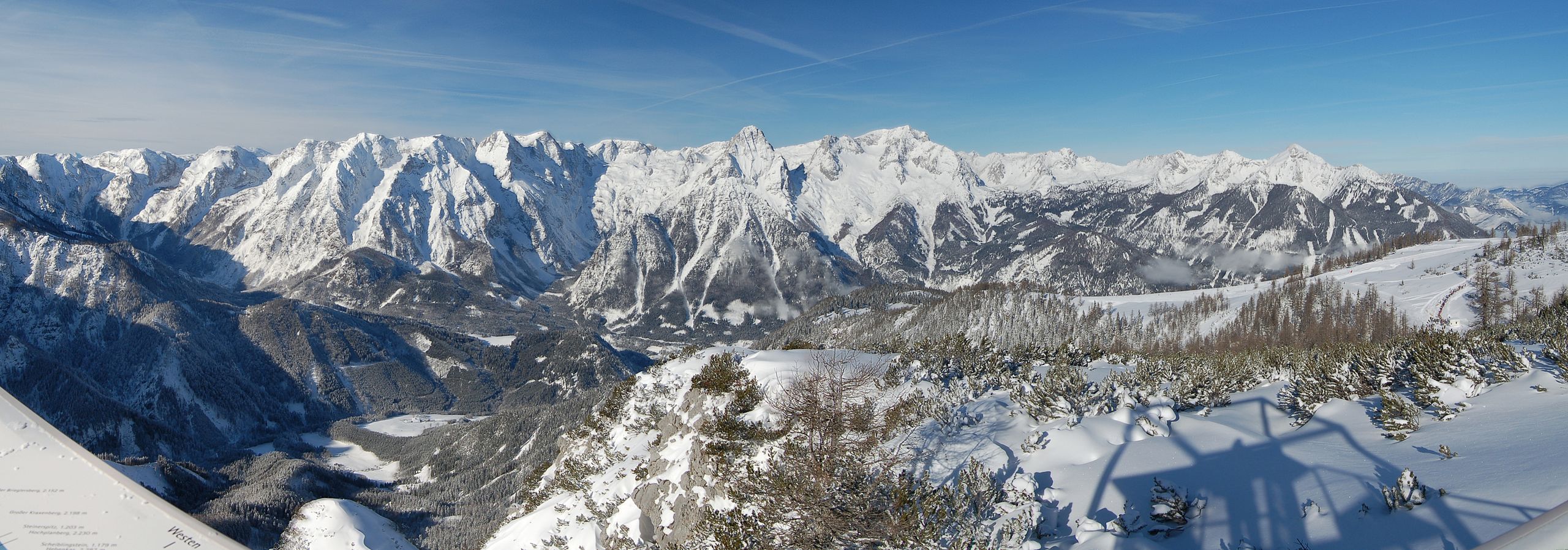
English: Totes Gebirge, Styria. East face of the mountain range falling down to the Stodertal. Here are the highest mountains of the group, Großer Priel (right), and Spitzmauer (left). For further details see annotations.
Deutsch: Totes Gebirge, Steiermark. Ostseite der Gruppe über dem hinteren Stodertal. Hier sind die höchsten Gipfel der Gruppe, Großer Priel (rechts), und Spitzmauer (links). Ganz rechts der kleine Priel. Mehr in den Annotierungen. |
| Petsa | |
| Gigikanan | Kaugalingong trabaho |
| Tagsulat | Herzi Pinki |
| Camera location | | View this and other nearby images on: OpenStreetMap |
|---|
This panoramic image was created with Autostitch (stitched images may differ from reality).
Pagtugot
I, the copyright holder of this work, hereby publish it under the following licenses:
This file is licensed under the Creative Commons Attribution-Share Alike 3.0 Unported license.
- Libre ka:
- sa pagsabwag – sa pagkopya, pag-apod-apod ug pagsabwag sa hinimo
- sa pag-remix – sa pag-adap sa binuhat
- Ubos sa mosunod nga mga kondisyon:
- atribusyon – Kinahanglan nimo nga hatagan ang angay nga kredito, maghatag usa ka link sa lisensya, ug ipakita kung adunay mga pagbag-o. Mahimo nimo kini buhaton sa bisan unsang makatarunganon nga paagi, apan dili sa bisan unsang paagi nga nagsugyot nga gi-endorso ka sa licensor o ang imong paggamit.
- share parehas – Kung imong gi-remix, gibag-o, o gibase sa materyal, kinahanglan nimo nga iapod-apod ang imong mga kontribusyon sa ilawom sa parehas o katugma nga lisensya sama sa orihinal.

|
Gitugot ang pagkopya, pag-apud-apod o/ug pag-usab ning maong dokumento ubos sa mga termino sa GNU Free Documentation License, Version 1.2 o mas bag-ong bersiyon nga gimantala sa Free Software Foundation; nga walay Invariant Sections, walay Front-Cover Texts, ug walay Back-Cover Texts. Ang kopya sa lisensiya gilakip sa bahin nga giulohang GNU Free Documentation License. |
You may select the license of your choice.
| Annotations | This image is annotated: View the annotations at Commons |
Kaagi sa payl
I-klik ang petsa/oras aron makit-an ang hulagway sa payl niadtong panahona.
| Petsa/Takna | Thumbnail | Mga dimensyon | Tiggamit | Komento | |
|---|---|---|---|---|---|
| kasamtangan | 00:07, 30 Enero 2013 | 6,000 × 2,104 (7.1 MB) | Slick-o-bot | Bot: convert to a non-interlaced jpeg (see bug #17645) | |
| 16:46, 21 Pebrero 2010 | 6,000 × 2,104 (6.78 MB) | Herzi Pinki | {{Information |Description={{en|1=Totes Gebirge, Styria. East face of the mountain range falling down to the Stodertal. Here are the highest mountains of the group, Großer Priel (right), and Spitzmauer (left). For further details see annotations.}} { |
Mga paggamit sa payl
Ang mosunod nga mga panid misumpay niining payl:
Global nga paggamit sa payl
Kining ubang wiki naggamit ning maong payl:
- Paggamit sa arz.wikipedia.org
- Paggamit sa de.wikipedia.org
- Paggamit sa he.wikipedia.org
- Paggamit sa sv.wikipedia.org
- Paggamit sa www.wikidata.org