Payl:Trebic vnitrni mesto hradek.jpg

Gidak-on ning maong paunang tan-aw: 800 x 580 ka mga piksel. Uban pang mga resoluyon: 320 x 232 ka mga piksel | 640 x 464 ka mga piksel | 1,024 x 742 ka mga piksel | 1,280 x 928 ka mga piksel | 1,500 x 1,087 ka mga piksel.
Tibuok resolusyon (1,500 × 1,087 pixels, size sa payl: 509 KB, MIME type: image/jpeg)
Mubong sugid:
| Deskripsyon |
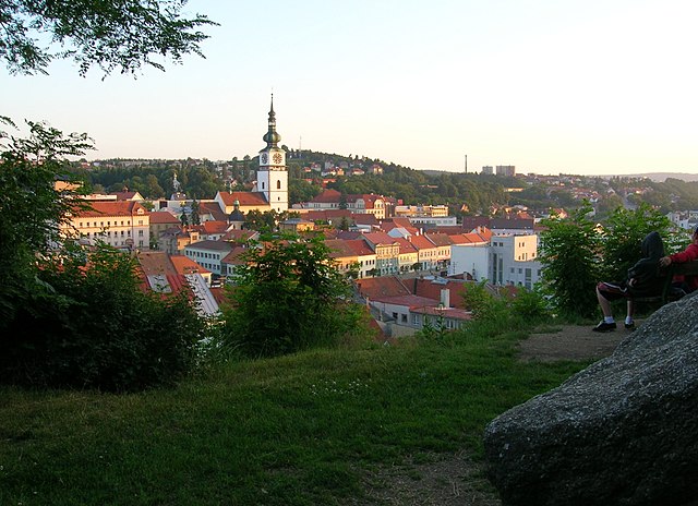
Čeština: Třebíč-Podklášteří. Hrádek. Pohled na Vnitřní Město, od Žižkovy mohyly. 49°13'2.67"N,15°52'57.89"E
English: Třebíč-Podklášteří. Hrádek. View of the Vnitřní Město, from the Žižka Monument |
||||||||
| Petsa | |||||||||
| Gigikanan | Kaugalingong trabaho | ||||||||
| Tagsulat | Nostrifikator | ||||||||
| Pagtugot (Paggamit pag-usab niini nga file) |
Nostrifikator, the copyright holder of this work, hereby publishes it under the following license:
This file is licensed under the Creative Commons Attribution-Share Alike 3.0 Unported, 2.5 Generic, 2.0 Generic and 1.0 Generic license.
|

| Camera location | | View this and other nearby images on: OpenStreetMap |
|---|
Kaagi sa payl
I-klik ang petsa/oras aron makit-an ang hulagway sa payl niadtong panahona.
| Petsa/Takna | Thumbnail | Mga dimensyon | Tiggamit | Komento | |
|---|---|---|---|---|---|
| kasamtangan | 13:25, 7 Oktubre 2007 | | 1,500 × 1,087 (509 KB) | Nostrifikator | {{Information |Description= {{cs|Třebíč-Podklášteří. Hrádek. Pohled na Vnitřní Město, od Žižkovy mohyly. 49°13'2.67"N,15°52'57.89"E}} {{en|Třebíč-Podklášteří. Hrádek. View of the Vnitřní Město, from the Žižka Monument}} |Source |
Mga paggamit sa payl
Ang mosunod nga mga panid misumpay niining payl:
Global nga paggamit sa payl
Kining ubang wiki naggamit ning maong payl:
- Paggamit sa ar.wikipedia.org
- Paggamit sa azb.wikipedia.org
- Paggamit sa az.wikipedia.org
- Paggamit sa ca.wikipedia.org
- Paggamit sa ce.wikipedia.org
- Paggamit sa cs.wikipedia.org
- Paggamit sa en.wikipedia.org
- Paggamit sa eo.wikipedia.org
- Paggamit sa es.wikipedia.org
- Paggamit sa eu.wikipedia.org
- Paggamit sa fi.wikipedia.org
- Paggamit sa fr.wikivoyage.org
- Paggamit sa he.wikipedia.org
- Paggamit sa hy.wikipedia.org
- Paggamit sa id.wikipedia.org
- Paggamit sa lmo.wikipedia.org
- Paggamit sa no.wikipedia.org
- Paggamit sa os.wikipedia.org
- Paggamit sa pl.wikipedia.org
- Paggamit sa pnb.wikipedia.org
- Paggamit sa ro.wikipedia.org
- Paggamit sa ru.wikipedia.org
- Paggamit sa sh.wikipedia.org
- Paggamit sa simple.wikipedia.org
- Paggamit sa sr.wikipedia.org
- Paggamit sa sv.wikipedia.org
- Paggamit sa tr.wikipedia.org
- Paggamit sa ur.wikipedia.org
- Paggamit sa vi.wikipedia.org
- Paggamit sa www.wikidata.org
- Paggamit sa zh.wikipedia.org