Payl:Triac-Lautrait 16 Pyramide Condé a 2013.jpg

Gidak-on ning maong paunang tan-aw: 800 x 493 ka mga piksel. Uban pang mga resoluyon: 320 x 197 ka mga piksel | 640 x 394 ka mga piksel | 1,024 x 631 ka mga piksel | 1,280 x 789 ka mga piksel | 2,560 x 1,577 ka mga piksel | 4,688 x 2,888 ka mga piksel.
Tibuok resolusyon (4,688 × 2,888 pixels, size sa payl: 13.43 MB, MIME type: image/jpeg)
Mubong sugid:
| Deskripsyon |
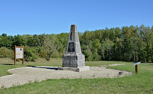
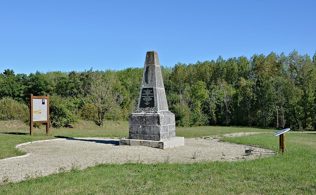
Français : Situation de la Pyramide de Condé (fin XVIIIe-début XIXe) édifiée sur les lieux de la mort de Louis de Bourbon, prince de Condé, lors de la bataille de Jarnac (1569). Triac-Lautrait, Charente, France.
English: Situation of the "Pyramide de Condé" (end of 18th-beginning of 19th century) built on the spot where Louis de Bourbon, Prince de condé, died during the battle of Jarnac (1569). Triac-Lautrait, Charente, France.
|
|
| Petsa | ||
| Gigikanan | Kaugalingong trabaho | |
| Tagsulat | ||
| Attribution (required by the license) | Photo: JLPC / Wikimedia Commons / | |
| Pagtugot (Paggamit pag-usab niini nga file) |
I, the copyright holder of this work, hereby publish it under the following license: This file is licensed under the Creative Commons Attribution-Share Alike 3.0 Unported license.
|
| Camera location | | View this and other nearby images on: OpenStreetMap |
|---|
| Annotations | This image is annotated: View the annotations at Commons |


|
This image has been assessed under the valued image criteria and is considered the most valued image on Commons within the scope: "Pyramide de Condé", Triac-Lautrait, Charente, France, SW view. You can see its nomination here. |
Kaagi sa payl
I-klik ang petsa/oras aron makit-an ang hulagway sa payl niadtong panahona.
| Petsa/Takna | Thumbnail | Mga dimensyon | Tiggamit | Komento | |
|---|---|---|---|---|---|
| kasamtangan | 13:34, 14 Oktubre 2013 | | 4,688 × 2,888 (13.43 MB) | JLPC |
Mga paggamit sa payl
Ang mosunod nga mga panid misumpay niining payl: