Payl:TroyWaterfrontPano.jpg

Gidak-on ning maong paunang tan-aw: 800 x 294 ka mga piksel. Uban pang mga resoluyon: 320 x 118 ka mga piksel | 640 x 235 ka mga piksel | 1,024 x 377 ka mga piksel | 1,280 x 471 ka mga piksel | 2,560 x 942 ka mga piksel | 7,012 x 2,579 ka mga piksel.
Tibuok resolusyon (7,012 × 2,579 pixels, size sa payl: 4.34 MB, MIME type: image/jpeg)

|
This image or media is part of a collection on the city of Troy, New York, known as the "Collar City" and the home of Samuel Wilson, the progenitor of Uncle Sam. More images and media relating to Troy and the Troy area can be found at the following media categories: Troy, New York | History of Troy, New York | Buildings in Troy, New York | Government of Troy, New York | Maps of Troy, New York | National Register of Historic Places in Troy, New York | Panoramas of Troy, New York | Rensselaer Polytechnic Institute | Russell Sage College | Hudson Valley Community College | Oakwood Cemetery
|

|
Mubong sugid:
| Deskripsyon |
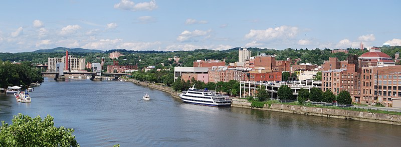
English: Waterfront of the city of Troy in New York, United States taken from the Collar City Bridge |
||
| Petsa | |||
| Gigikanan | Kaugalingong trabaho | ||
| Tagsulat |
|

| Camera location | | View this and other nearby images on: OpenStreetMap |
|---|
Pagtugot
I, the copyright holder of this work, hereby publish it under the following license:
This file is licensed under the Creative Commons Attribution-Share Alike 3.0 Unported license.
- Libre ka:
- sa pagsabwag – sa pagkopya, pag-apod-apod ug pagsabwag sa hinimo
- sa pag-remix – sa pag-adap sa binuhat
- Ubos sa mosunod nga mga kondisyon:
- atribusyon – Kinahanglan nimo nga hatagan ang angay nga kredito, maghatag usa ka link sa lisensya, ug ipakita kung adunay mga pagbag-o. Mahimo nimo kini buhaton sa bisan unsang makatarunganon nga paagi, apan dili sa bisan unsang paagi nga nagsugyot nga gi-endorso ka sa licensor o ang imong paggamit.
- share parehas – Kung imong gi-remix, gibag-o, o gibase sa materyal, kinahanglan nimo nga iapod-apod ang imong mga kontribusyon sa ilawom sa parehas o katugma nga lisensya sama sa orihinal.
Kaagi sa payl
I-klik ang petsa/oras aron makit-an ang hulagway sa payl niadtong panahona.
| Petsa/Takna | Thumbnail | Mga dimensyon | Tiggamit | Komento | |
|---|---|---|---|---|---|
| kasamtangan | 02:43, 31 Hulyo 2009 | 7,012 × 2,579 (4.34 MB) | MattWade | {{Information |Description={{en|1=Waterfront of the city of Troy in en:New York, en:United States taken from the en:Collar City Bridge}} |Source=Own work by uploader |Author=Wadester16 |Date=200 |
Mga paggamit sa payl
Ang mosunod nga mga panid misumpay niining payl:
Global nga paggamit sa payl
Kining ubang wiki naggamit ning maong payl:
- Paggamit sa ar.wikipedia.org
- Paggamit sa azb.wikipedia.org
- Paggamit sa be.wikipedia.org
- Paggamit sa bg.wikipedia.org
- Paggamit sa ca.wikipedia.org
- Paggamit sa ce.wikipedia.org
- Paggamit sa cs.wikipedia.org
- Paggamit sa cy.wikipedia.org
- Paggamit sa en.wikipedia.org
- Paggamit sa en.wikivoyage.org
- Paggamit sa eo.wikipedia.org
- Paggamit sa es.wikipedia.org
- Paggamit sa eu.wikipedia.org
- Paggamit sa fa.wikipedia.org
- Paggamit sa fi.wikipedia.org
- Paggamit sa fr.wikipedia.org
- Paggamit sa gl.wikipedia.org
- Paggamit sa he.wikivoyage.org
- Paggamit sa ht.wikipedia.org
- Paggamit sa hu.wikipedia.org
- Paggamit sa hy.wikipedia.org
- Paggamit sa incubator.wikimedia.org
- Paggamit sa it.wikipedia.org
- Paggamit sa ko.wikipedia.org
- Paggamit sa kw.wikipedia.org
- Paggamit sa lld.wikipedia.org
- Paggamit sa no.wikipedia.org
- Paggamit sa pl.wikipedia.org
- Paggamit sa pnb.wikipedia.org
- Paggamit sa ro.wikipedia.org
- Paggamit sa ru.wikipedia.org
- Paggamit sa sr.wikipedia.org
- Paggamit sa sv.wikipedia.org
- Paggamit sa szl.wikipedia.org
- Paggamit sa tl.wikipedia.org
- Paggamit sa tr.wikipedia.org
- Paggamit sa tt.wikipedia.org
- Paggamit sa uk.wikipedia.org
- Paggamit sa ur.wikipedia.org
- Paggamit sa vo.wikipedia.org
- Paggamit sa www.wikidata.org
- Paggamit sa zh-min-nan.wikipedia.org