Payl:Tunisia adm location map.svg

Tibuok resolusyon (SVG nga payl, nominally 378 × 743 pixels, size sa payl: 162 KB)
Mubong sugid:
| Deskripsyon |
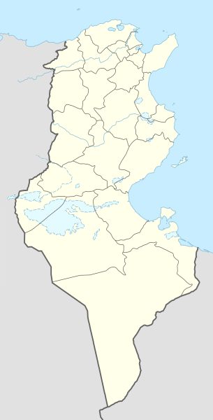
Deutsch: Positionskarte von Tunesien
English: Location map of Tunisia
|
||||||||||||
| Petsa | |||||||||||||
| Gigikanan |
Own work using:
|
||||||||||||
| Tagsulat | NordNordWest | ||||||||||||

|
This map has been made or improved in the German Kartenwerkstatt (Map Lab). You can propose maps to improve as well.
|
Pagtugot
Usage of this file with:

explanatory notes: Legally binding is only the full legalcode. For a free usage I recommend to respect the following licence conditions:
1. Provide my name as given above: NordNordWest,
2. a copy of, or the URI for, the applicable license: https://creativecommons.org/licenses/by-sa/3.0/de/legalcode,
3. the title of the work,
4. in the case of an adaptation, a credit identifying the use of the work in the adaptation.
This license and the rights granted hereunder will terminate automatically upon any breach by you of the terms of this license. Any of the above conditions can be waived if you get permission from the copyright holder. If you have questions or wish differing conditions, please contact me through nnwest or my discussion page ![]() t-online.de
t-online.de
- Libre ka:
- sa pagsabwag – sa pagkopya, pag-apod-apod ug pagsabwag sa hinimo
- sa pag-remix – sa pag-adap sa binuhat
- Ubos sa mosunod nga mga kondisyon:
- atribusyon – Kinahanglan nimo nga hatagan ang angay nga kredito, maghatag usa ka link sa lisensya, ug ipakita kung adunay mga pagbag-o. Mahimo nimo kini buhaton sa bisan unsang makatarunganon nga paagi, apan dili sa bisan unsang paagi nga nagsugyot nga gi-endorso ka sa licensor o ang imong paggamit.
- share parehas – Kung imong gi-remix, gibag-o, o gibase sa materyal, kinahanglan nimo nga iapod-apod ang imong mga kontribusyon sa ilawom sa parehas o katugma nga lisensya sama sa orihinal.

Kaagi sa payl
I-klik ang petsa/oras aron makit-an ang hulagway sa payl niadtong panahona.
| Petsa/Takna | Thumbnail | Mga dimensyon | Tiggamit | Komento | |
|---|---|---|---|---|---|
| kasamtangan | 12:03, 24 Marso 2024 | | 378 × 743 (162 KB) | GrandEscogriffe | more correct north-south stretching |
| 15:59, 9 Nobiyembre 2014 |  | 378 × 713 (146 KB) | NordNordWest | == {{int:filedesc}} == {{Information |Description= {{de|1=Positionskarte von Tunesien}} {{en|1=Location map of Tunisia}} {{Location map series N |stretching=115 |top=37.7 |bottom=30.0 |left=7.2 |right=11.9 }} |Source={{Own using}} * United States Natio... |
Mga paggamit sa payl
More than 100 pages use this file. The following list shows the first 100 pages that use this file only. A full list is available.
- Ain ech Cheikh
- Ain er Rihane
- Ain es Safsaf
- Ain es Sghir
- Al Jubayl
- Al Muḩammadīyah
- Al Qaşr
- Aïn Ahmed
- Aïn el Beïda
- Aïn el Hajar
- Aïn el Hamra
- Aïn es Safsaf
- Bardo
- Cape Negro
- Dorsale
- El Ksar
- Jabal Mūsá
- Jabal al Milḩ
- Jabal al Qulay‘ah
- Jabal al Wasţ
- Jabal ar Ru’ays
- Jabal ar Ru’ūs
- Jabal az Zu‘rūr
- Jabal Şāliḩ
- Jebel Hadid
- Jebel Mekki
- Kebili
- Kouka
- Kébili
- Monastir
- Port de Pêche
- Razina
- Ra’s ar Raml
- Sers (pagklaro)
- Tala
- Tinja
- Wādī Barqah
- Wādī Ghazālah
- Wādī Ra’s al Mā’
- Wādī Sa‘dān
- Wādī Za‘farān
- Wādī adh Dhi’b
- Wādī al Abyaḑ
- Wādī al Aḩmar
- Wādī al Bi’r
- Wādī al Fūl
- Wādī al Kabīr
- Wādī al Kharrūb
- Wādī al Maqsam
- Wādī al Qanţarah
- Wādī al Qaws
- Wādī al Qaşab
- Wādī al Ḩajar
- Wādī al Ḩammām
- Wādī al ‘Ayn
- Wādī al ‘Ullayq
- Wādī al ‘Ushūsh
- Wādī al ‘Uyūn
- Wādī an Nakhlah
- Wādī ar Raml
- Wādī ar Rayḩān
- Wādī as Sadd
- Wādī as Salūqī
- Wādī as Saqy
- Wādī as Sikkah
- Wādī ash Sharqī
- Wādī ash Sharshārah
- Wādī ash Sha‘īr
- Wādī az Zarqā’
- Wādī az Zaytūn
- Wādī az Zaytūnah
- Wādī az Zu‘rūr
- Wādī aş Şafşāf
- Wādī aş Şawma‘ah
- Wādī aş Şawwān
- Zuila
- ‘Ayn Sa‘īd
- ‘Ayn Yūnus
- ‘Ayn ad Dāliyah
- ‘Ayn al Azraq
- ‘Ayn al Bayḑā’
- ‘Ayn al Birkah
- ‘Ayn al Jadīdah
- ‘Ayn al Jamal
- ‘Ayn al Khaḑrā’
- ‘Ayn al Māliḩah
- ‘Ayn al Qaşab
- ‘Ayn al Quşayr
- ‘Ayn al Wādī
- ‘Ayn al Ḩajar
- ‘Ayn al Ḩamrā’
- ‘Ayn ar Raml
- ‘Ayn as Sayyid
- ‘Ayn ash Shaykh
- ‘Ayn at Tallah
- ‘Ayn az Zaytūnah
- ‘Ayn az Zu‘rūrah
- ‘Ayn aş Şafşāf
- ‘Ayn aş Şafşāfah
- ‘Ayn aş Şaghīr
View more links to this file.
Global nga paggamit sa payl
Kining ubang wiki naggamit ning maong payl:
- Paggamit sa af.wikipedia.org
- Paggamit sa am.wikipedia.org
- Paggamit sa an.wikipedia.org
- Paggamit sa ar.wikipedia.org
- عروج بربروس
- الرابطة التونسية المحترفة الأولى
- كأس الأمم الإفريقية 2004
- باردو
- قائمة مطارات تونس
- كأس الأمم الإفريقية 1994
- النادي الإفريقي
- قالب:خريطة مدن تونس
- قالب:خارطة جبال تونس
- قالب:خريطة مواقع تونس
- كأس الأمم الإفريقية 1965
- قائمة مدن تونس المتوأمة
- بطولة أمم إفريقيا لكرة السلة 2015
- قالب:خريطة مواقع التراث العالمي في تونس
- قائمة مواقع التراث العالمي في تونس
- قالب:ص.م/موقع جغرافي مضاعف
- قالب:ص.م/موقع جغرافي مضاعف/شرح
- بوابة:التراث العالمي/خريطة مختارة
- الرابطة التونسية المحترفة الأولى 2015–16
- بطولة إفريقيا لكرة اليد للرجال 2020
- بطولة أمم إفريقيا لكرة السلة 2017
- الرابطة التونسية المحترفة الأولى 2016–17
- الرابطة التونسية المحترفة الأولى 2017–18
- الرابطة التونسية المحترفة الأولى 2018–19
- كلاسيكو تونس
- ديربي تونس الصغير
- الحي الوطني الرياضي
- الرابطة التونسية المحترفة الأولى 2019–20
- وادي الساقي
- وادي سيدي صالح
- الرابطة التونسية المحترفة الأولى 2020–21
- دورة تونس للأمم الأربعة 2003
- وحدة:Location map/data/تونس
- وحدة:Location map/data/تونس/شرح
- كأس إل جي الدولية 1997 (تونس)
- كأس إل جي الدولية 2006 (تونس)
- الرابطة التونسية المحترفة الأولى 2021–22
- بطولة إفريقيا لكرة اليد للرجال 2006
- الرابطة التونسية المحترفة الأولى 2022–23
- جبال تبسة
- الرابطة التونسية المحترفة الأولى 2023–24
- Paggamit sa ast.wikipedia.org
View more global usage of this file.