Payl:Turkey relief location map.jpg

Gidak-on ning maong paunang tan-aw: 800 x 343 ka mga piksel. Uban pang mga resoluyon: 320 x 137 ka mga piksel | 640 x 274 ka mga piksel | 1,579 x 677 ka mga piksel.
Tibuok resolusyon (1,579 × 677 pixels, size sa payl: 749 KB, MIME type: image/jpeg)
| Deskripsyon |
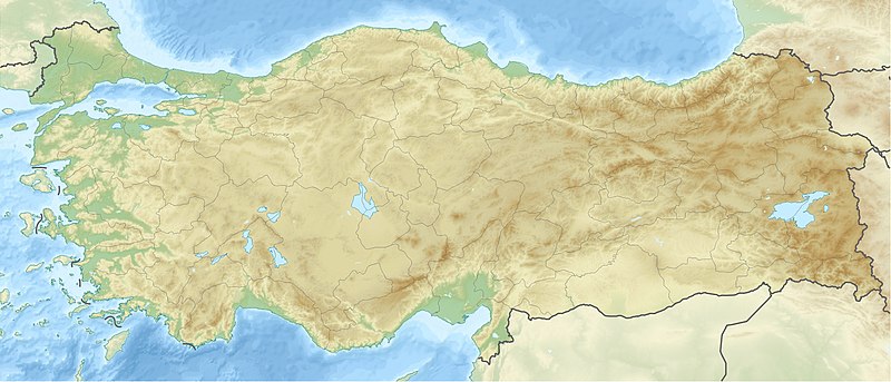
Deutsch: Positionskarte der Türkei Quadratische Plattkarte, N-S-Streckung 120 %. Geographische Begrenzung der Karte: * N: 42.5° N * S: 35.5° N * W: 25.4° O * O: 45.0° O English: Location map of Turkey Equirectangular projection, N/S stretching 120 %. Geographic limits of the map: * N: 42.5° N * S: 35.5° N * W: 25.4° E * E: 45.0° E |
| Petsa | (UTC) |
| Gigikanan | |
| Tagsulat |
|
| Other versions |
|

| This is a retouched picture, which means that it has been digitally altered from its original version. The original can be viewed here: Turkey location map.svg:
|
I, the copyright holder of this work, hereby publish it under the following licenses:
This file is licensed under the Creative Commons Attribution-Share Alike 3.0 Unported license.
- Libre ka:
- sa pagsabwag – sa pagkopya, pag-apod-apod ug pagsabwag sa hinimo
- sa pag-remix – sa pag-adap sa binuhat
- Ubos sa mosunod nga mga kondisyon:
- atribusyon – Kinahanglan nimo nga hatagan ang angay nga kredito, maghatag usa ka link sa lisensya, ug ipakita kung adunay mga pagbag-o. Mahimo nimo kini buhaton sa bisan unsang makatarunganon nga paagi, apan dili sa bisan unsang paagi nga nagsugyot nga gi-endorso ka sa licensor o ang imong paggamit.
- share parehas – Kung imong gi-remix, gibag-o, o gibase sa materyal, kinahanglan nimo nga iapod-apod ang imong mga kontribusyon sa ilawom sa parehas o katugma nga lisensya sama sa orihinal.

|
Gitugot ang pagkopya, pag-apud-apod o/ug pag-usab ning maong dokumento ubos sa mga termino sa GNU Free Documentation License, Version 1.2 o mas bag-ong bersiyon nga gimantala sa Free Software Foundation; nga walay Invariant Sections, walay Front-Cover Texts, ug walay Back-Cover Texts. Ang kopya sa lisensiya gilakip sa bahin nga giulohang GNU Free Documentation License. |
You may select the license of your choice.
Original upload log
This image is a derivative work of the following images:
- File:Turkey_location_map.svg licensed with Cc-by-sa-3.0, GFDL
- 2008-07-19T19:49:14Z NordNordWest 1579x677 (999148 Bytes) {{Information |Description= {{de|Positionskarte der [[:de:Türkei|Türkei]]}} Quadratische Plattkarte, N-S-Streckung 120 %. Geographische Begrenzung der Karte: * N: 42.5° N * S: 35.5° N * W: 25.4° O * O: 45.0° O {{en|Loca
Uploaded with derivativeFX
| Annotations | This image is annotated: View the annotations at Commons |
Kaagi sa payl
I-klik ang petsa/oras aron makit-an ang hulagway sa payl niadtong panahona.
| Petsa/Takna | Thumbnail | Mga dimensyon | Tiggamit | Komento | |
|---|---|---|---|---|---|
| kasamtangan | 12:42, 28 Hunyo 2010 | | 1,579 × 677 (749 KB) | Uwe Dedering | {{Information |Description={{de|Positionskarte der Türkei}} Quadratische Plattkarte, N-S-Streckung 120 %. Geographische Begrenzung der Karte: * N: 42.5° N * S: 35.5° N * W: 25.4° O * O: 45.0° O {{en|Location map of [[:en:Turkey|Turkey |
Mga paggamit sa payl
Ang mosunod nga mga panid misumpay niining payl:
Global nga paggamit sa payl
Kining ubang wiki naggamit ning maong payl:
- Paggamit sa als.wikipedia.org
- Paggamit sa am.wikipedia.org
- Paggamit sa ar.wikipedia.org
- قالب:خريطة مواقع تركيا
- فالق شمال الأناضول
- مستخدم:عبد المؤمن/مسودات/خرائط/تركيا
- مستخدم:"Yahia"/ملعب
- نهر مراد
- وحدة:Location map/data/Turkey
- وحدة:Location map/data/Turkey/شرح
- نفق الاستقلال 15 يوليو
- أطلس جت الرحلة 4203
- أولودنيز
- زلزال معمورة العزيز 2020
- قونور ألب
- الاشتباكات الحدودية التركية السورية خلال الحرب الأهلية السورية
- زلزال قهرمان مرعش 2023
- زلزال أرزنجان 1939
- زلزال أضنة وجيحان 1998
- زلزال أميك 1872
- Paggamit sa arz.wikipedia.org
- Paggamit sa ast.wikipedia.org
- Paggamit sa av.wikipedia.org
- Paggamit sa azb.wikipedia.org
- Paggamit sa az.wikipedia.org
View more global usage of this file.