Payl:USA Mississippi location map.svg

Size of this PNG preview of this SVG file: 377 x 600 ka mga piksel. Uban pang mga resoluyon: 151 x 240 ka mga piksel | 301 x 480 ka mga piksel | 482 x 768 ka mga piksel | 643 x 1,024 ka mga piksel | 1,287 x 2,048 ka mga piksel | 754 x 1,200 ka mga piksel.
Tibuok resolusyon (SVG nga payl, nominally 754 × 1,200 pixels, size sa payl: 619 KB)
Mubong sugid:
| Deskripsyon |
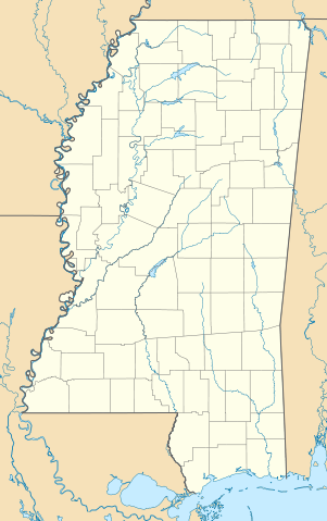
Quadratische Plattkarte, N-S-Streckung 120.0 %. Geographische Begrenzung der Karte:
Equirectangular projection, N/S stretching 120.0 %. Geographic limits of the map:
|
| Petsa | |
| Gigikanan | Kaugalingong trabaho |
| Tagsulat | Alexrk2 |
| Other versions |
Derivative works of this file: Natchez Massacre location.png Derivative works of this file: |

|
This map has been made or improved in the German Kartenwerkstatt (Map Lab). You can propose maps to improve as well.
|
Pagtugot
I, the copyright holder of this work, hereby publish it under the following licenses:

|
Gitugot ang pagkopya, pag-apud-apod o/ug pag-usab ning maong dokumento ubos sa mga termino sa GNU Free Documentation License, Version 1.2 o mas bag-ong bersiyon nga gimantala sa Free Software Foundation; nga walay Invariant Sections, walay Front-Cover Texts, ug walay Back-Cover Texts. Ang kopya sa lisensiya gilakip sa bahin nga giulohang GNU Free Documentation License. |
This file is licensed under the Creative Commons Attribution 3.0 Unported license.
- Libre ka:
- sa pagsabwag – sa pagkopya, pag-apod-apod ug pagsabwag sa hinimo
- sa pag-remix – sa pag-adap sa binuhat
- Ubos sa mosunod nga mga kondisyon:
- atribusyon – Kinahanglan nimo nga hatagan ang angay nga kredito, maghatag usa ka link sa lisensya, ug ipakita kung adunay mga pagbag-o. Mahimo nimo kini buhaton sa bisan unsang makatarunganon nga paagi, apan dili sa bisan unsang paagi nga nagsugyot nga gi-endorso ka sa licensor o ang imong paggamit.
You may select the license of your choice.
Kaagi sa payl
I-klik ang petsa/oras aron makit-an ang hulagway sa payl niadtong panahona.
| Petsa/Takna | Thumbnail | Mga dimensyon | Tiggamit | Komento | |
|---|---|---|---|---|---|
| kasamtangan | 12:33, 20 Hunyo 2009 | | 754 × 1,200 (619 KB) | Alexrk2 | == Beschreibung == {{Information |Description= {{de|Positionskarte von Mississippi, USA}} Quadratische Plattkarte, N-S-Streckung 120.0 %. Geographische Begrenzung der Karte: * N: 35.2° N * S: 29.9° N * W: 91.9° W * O: 87 |
Mga paggamit sa payl
Ang mosunod nga mga panid misumpay niining payl:
Global nga paggamit sa payl
Kining ubang wiki naggamit ning maong payl:
- Paggamit sa af.wikipedia.org
- Paggamit sa an.wikipedia.org
- Paggamit sa ar.wikipedia.org
- Paggamit sa azb.wikipedia.org
- جکسون، میسیسیپی
- یازو سیتی، میسیسیپی
- ویکسبرق، میسیسیپی
- اسالتیلو، میسیسیپی
- نچیز، میسیسیپی
- قالفپورت، میسیسیپی
- پانتوتوک، میسیسیپی
- ویکسبرق موحاصیرهسی
- پالدینق، میسیسیپی
- استار، میسیسیپی
- پرکینستن، میسیسیپی
- واینات، میسیسیپی
- اولان، میسیسیپی
- مانی، میسیسیپی
- آرکاباتلا، میسیسیپی
- بلدن، میسیسیپی
- داندی، میسیسیپی
- تیوک، میسیسیپی
- براونینق، میسیسیپی
- مینتر سیتی، میسیسیپی
- هاردی، میسیسیپی
- دنیس، میسیسیپی
- نسبیت، میسیسیپی
- لورمن، میسیسیپی
- فرویو، میسیسیپی
- کایل، میسیسیپی
- برکلیر، میسیسیپی
- بارتون، میسیسیپی
- پاریس، میسیسیپی
- ایقل بند، میسیسیپی
- بووینا، میسیسیپی
- ردوود، میسیسیپی
- فلاورز، میسیسیپی
- یودرا، میسیسیپی
- هالیوود، میسیسیپی
- نیکولسن، میسیسیپی
- دوایر، میسیسیپی
- هاسینتو، میسیسیپی
- ادینبورق، میسیسیپی
- بنتن، میسیسیپی
- هیلزبورو، میسیسیپی
- چرچ هیل، میسیسیپی
- آبویل، میسیسیپی
- آکونا، میسیسیپی
- موزکوو، میسیسیپی
- آقریکولا، میسیسیپی
View more global usage of this file.