Payl:Uganda location map.svg

Tibuok resolusyon (SVG nga payl, nominally 1,441 × 1,466 pixels, size sa payl: 431 KB)
Mubong sugid:
| Deskripsyon |
Deutsch: Positionskarte von Uganda
Quadratische Plattkarte. Geographische Begrenzung der Karte:
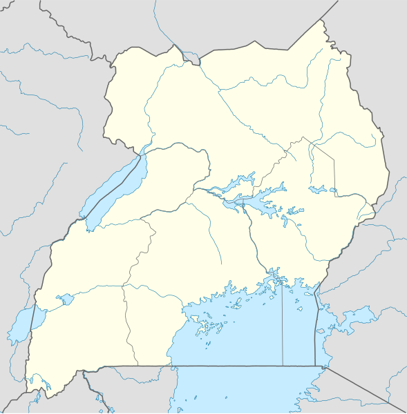
English: Location map of Uganda
Equirectangular projection. Geographic limits of the map:
|
|
| Petsa | ||
| Gigikanan |
Kaugalingong trabaho, using
|
|
| Tagsulat | NordNordWest | |
| Pagtugot (Paggamit pag-usab niini nga file) |
This file is licensed under the Creative Commons Attribution-Share Alike 3.0 Germany license.
 This file is licensed under the Creative Commons Attribution-Share Alike 3.0 Germany license.
|
|
| Other versions |
Derivative works of this file: Uganda location map Topographic.png |


|
This map has been made or improved in the German Kartenwerkstatt (Map Lab). You can propose maps to improve as well.
|
Kaagi sa payl
I-klik ang petsa/oras aron makit-an ang hulagway sa payl niadtong panahona.
| Petsa/Takna | Thumbnail | Mga dimensyon | Tiggamit | Komento | |
|---|---|---|---|---|---|
| kasamtangan | 19:25, 1 Disyembre 2009 | | 1,441 × 1,466 (431 KB) | NordNordWest | =={{int:filedesc}}== {{Information |Description= {{de|Positionskarte von Uganda}} Quadratische Plattkarte. Geographische Begrenzung der Karte: * N: 4.5° N * S: 1.7° S * W: 29.2° O * O: 35.3° O {{en|Location map of Uganda} |
Mga paggamit sa payl
More than 100 pages use this file. The following list shows the first 100 pages that use this file only. A full list is available.
- Abia
- Achwa
- Adala
- Adok
- Adyang
- Agar
- Agu
- Agwok
- Akur
- Ala
- Alu
- Anari
- Aswa
- Atem
- Azi
- Bala
- Banda
- Barr (pagklaro)
- Biri
- Daga
- Del
- Eru
- Gula
- Gulu
- Ikolong
- Iru
- Isa
- Ituko
- Kachinga
- Kagwa
- Kahala
- Kal
- Kaliro
- Kanara
- Kanga
- Kapedo
- Karenga
- Karita (pagklaro)
- Kedi
- Kei
- Kirima
- Kita
- Kizi
- Kochol
- Kolinyang
- Korao
- Kori
- Kuju
- Lake George
- Langia Mountains
- Lina
- Linna
- Lira
- Logiri
- Loitanit
- Lokwamur
- Loma
- Lopi
- Lopur
- Loyoro
- Ludara
- Luga
- Luko
- Madudu
- Maluba
- Manga (pagklaro)
- Molo (pagklaro)
- Morongole
- Mpanga
- Muka
- Mulinda
- Mutuntu
- Namba
- Nambiri
- Ngoma (pagklaro)
- Nyabisheke
- Nyankende
- Nyara
- Okok
- Omit
- Oru
- Paya
- Polli
- Rupa
- Rushenyi
- Sango
- Sasa (pagklaro)
- Sella
- Simba
- Taba
- Tarach
- Timan
- Titi
- Tula (pagklaro)
- Tumbi
- Unyama
- Uru
- Uu
- Wara
- Gumagamit:Lsjbot/geotest/Sella (pagklaro)
View more links to this file.
Global nga paggamit sa payl
Kining ubang wiki naggamit ning maong payl:
- Paggamit sa af.wikipedia.org
- Paggamit sa am.wikipedia.org
- Paggamit sa an.wikipedia.org
- Paggamit sa ar.wikipedia.org
- Paggamit sa ast.wikipedia.org
- Paggamit sa av.wikipedia.org
- Paggamit sa azb.wikipedia.org
- Paggamit sa az.wikipedia.org
- Paggamit sa be-tarask.wikipedia.org
- Paggamit sa be.wikipedia.org
View more global usage of this file.