Payl:Wfm firth of forth.jpg

Gidak-on ning maong paunang tan-aw: 800 x 593 ka mga piksel. Uban pang mga resoluyon: 320 x 237 ka mga piksel | 640 x 474 ka mga piksel | 1,024 x 758 ka mga piksel | 1,280 x 948 ka mga piksel.
Tibuok resolusyon (1,280 × 948 pixels, size sa payl: 289 KB, MIME type: image/jpeg)
Mubong sugid:
| Deskripsyon |
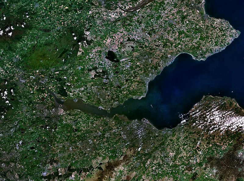
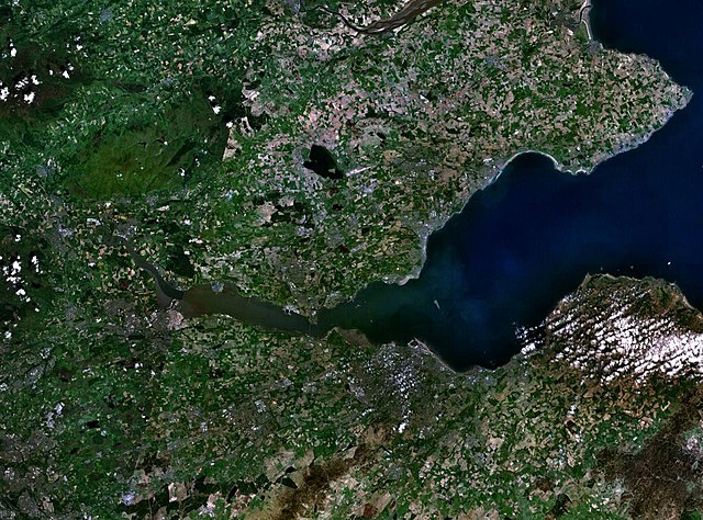
English: The Firth of the river Forth, on the east coast of Scotland. The two forth bridges are visible near the centre of the frame. Stirling is at the extreme left side. |
| Petsa | 3 Agosto 2005 (upload date) |
| Gigikanan | Satellite imagery taken by screenshot from NASA World Wind software |
| Tagsulat | NASA |
Pagtugot
| This image is in the public domain because it is a screenshot from NASA’s globe software World Wind using a public domain layer, such as Blue Marble, MODIS, Landsat, SRTM, USGS or GLOBE.
|
 |
Kaagi sa payl
I-klik ang petsa/oras aron makit-an ang hulagway sa payl niadtong panahona.
| Petsa/Takna | Thumbnail | Mga dimensyon | Tiggamit | Komento | |
|---|---|---|---|---|---|
| kasamtangan | 09:38, 3 Agosto 2005 | | 1,280 × 948 (289 KB) | Finlay McWalter | The Firth of the river Forth, on the east coast of Scotland. The two forth bridges are visible near the centre of the frame. Stirling is at the extreme left side. Image made with NASA World Wind. {{PD-USGov-NASA}} category:satellite photos |
Mga paggamit sa payl
Ang mosunod nga mga panid misumpay niining payl:
Global nga paggamit sa payl
Kining ubang wiki naggamit ning maong payl:
- Paggamit sa ar.wikipedia.org
- Paggamit sa be.wikipedia.org
- Paggamit sa bg.wikipedia.org
- Paggamit sa br.wikipedia.org
- Paggamit sa ca.wikipedia.org
- Paggamit sa cs.wikipedia.org
- Paggamit sa cy.wikipedia.org
- Paggamit sa de.wikipedia.org
- Paggamit sa el.wikipedia.org
- Paggamit sa en.wikipedia.org
- Paggamit sa en.wikivoyage.org
- Paggamit sa eo.wikipedia.org
- Paggamit sa es.wikipedia.org
- Paggamit sa et.wikipedia.org
- Paggamit sa eu.wikipedia.org
- Paggamit sa fa.wikipedia.org
- Paggamit sa fr.wikipedia.org
- Paggamit sa ga.wikipedia.org
- Paggamit sa gd.wikipedia.org
- Paggamit sa ha.wikipedia.org
- Paggamit sa he.wikipedia.org
- Paggamit sa hi.wikipedia.org
- Paggamit sa ia.wikipedia.org
- Paggamit sa is.wikipedia.org
- Paggamit sa it.wikipedia.org
- Paggamit sa it.wikivoyage.org
- Paggamit sa ja.wikipedia.org
- Paggamit sa kbd.wikipedia.org
- Paggamit sa lt.wikipedia.org
- Paggamit sa mt.wikipedia.org
- Paggamit sa nl.wikipedia.org
- Paggamit sa nn.wikipedia.org
- Paggamit sa no.wikipedia.org
- Paggamit sa pl.wikipedia.org
- Paggamit sa pt.wikipedia.org
- Paggamit sa ro.wikipedia.org
- Paggamit sa ru.wikipedia.org
- Paggamit sa sco.wikipedia.org
View more global usage of this file.