Payl:Williams-Point.jpg
Gidak-on ning maong paunang tan-aw: 800 x 599 ka mga piksel. Uban pang mga resoluyon: 320 x 240 ka mga piksel | 640 x 479 ka mga piksel | 1,024 x 766 ka mga piksel | 1,280 x 958 ka mga piksel | 2,608 x 1,952 ka mga piksel.
Tibuok resolusyon (2,608 × 1,952 pixels, size sa payl: 1.82 MB, MIME type: image/jpeg)
Mubong sugid:
| Deskripsyon |
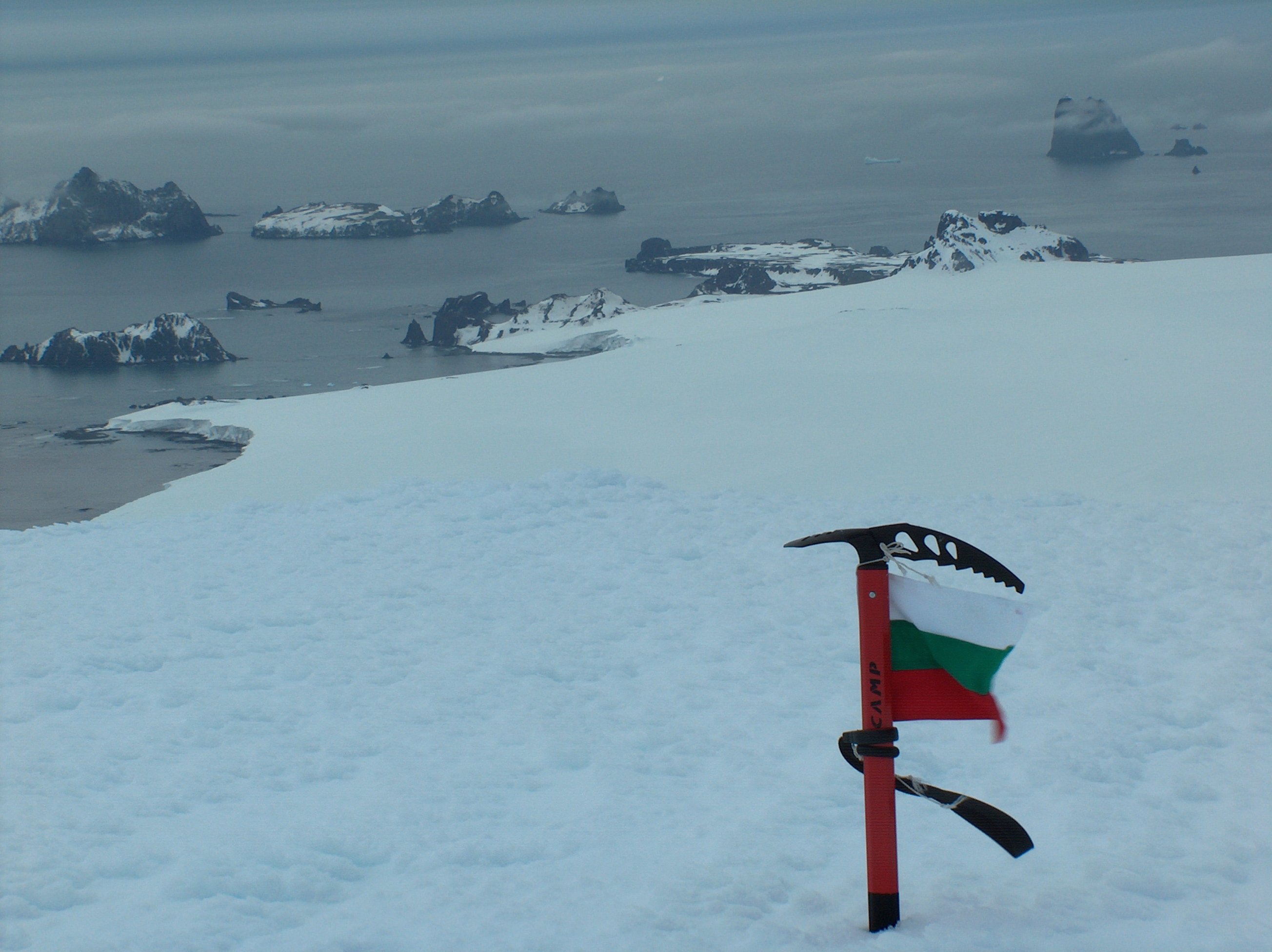
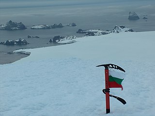
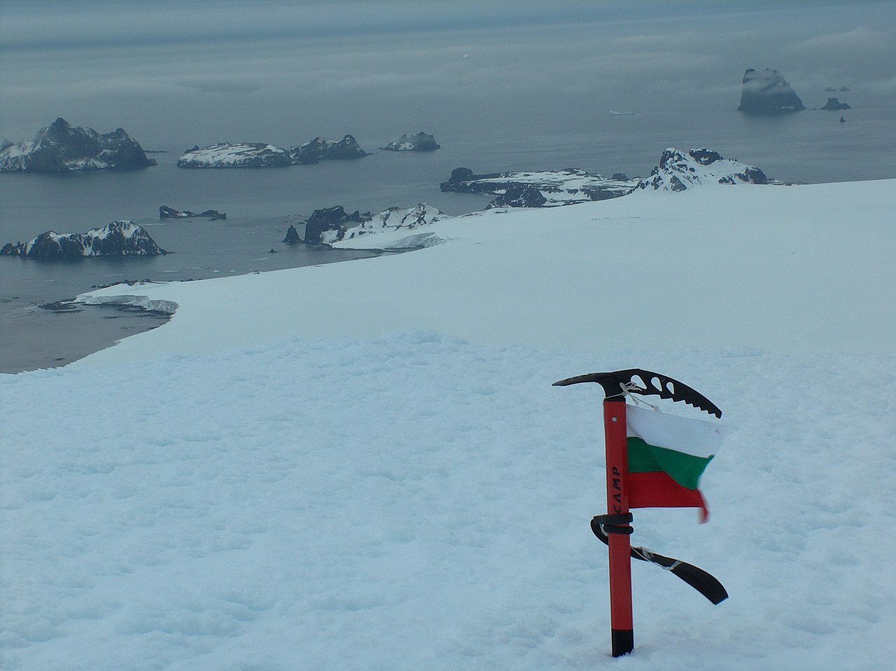
English: Williams Point, Livingston Island in the South Shetland Islands; the first land ever discovered south of 60˚ south latitude, on February 19, 1819. Left to right Slab Point, Organpipe Point, and Williams Point surmounted by Sayer Nunatak, from Miziya Peak, with Zavala Island in the foreground, Zed Islands in the left background, and Pyramid Island on the right
Español: Punta Williams, descubierto el 19 de febrero de 1819 |
| Petsa | |
| Gigikanan | Kaugalingong trabaho |
| Tagsulat | Apcbg |
| Camera location | | View this and other nearby images on: OpenStreetMap |
|---|
Pagtugot
I, the copyright holder of this work, hereby publish it under the following license:
This file is licensed under the Creative Commons Attribution-Share Alike 4.0 International license.
- Libre ka:
- sa pagsabwag – sa pagkopya, pag-apod-apod ug pagsabwag sa hinimo
- sa pag-remix – sa pag-adap sa binuhat
- Ubos sa mosunod nga mga kondisyon:
- atribusyon – Kinahanglan nimo nga hatagan ang angay nga kredito, maghatag usa ka link sa lisensya, ug ipakita kung adunay mga pagbag-o. Mahimo nimo kini buhaton sa bisan unsang makatarunganon nga paagi, apan dili sa bisan unsang paagi nga nagsugyot nga gi-endorso ka sa licensor o ang imong paggamit.
- share parehas – Kung imong gi-remix, gibag-o, o gibase sa materyal, kinahanglan nimo nga iapod-apod ang imong mga kontribusyon sa ilawom sa parehas o katugma nga lisensya sama sa orihinal.
Kaagi sa payl
I-klik ang petsa/oras aron makit-an ang hulagway sa payl niadtong panahona.
| Petsa/Takna | Thumbnail | Mga dimensyon | Tiggamit | Komento | |
|---|---|---|---|---|---|
| kasamtangan | 08:59, 2 Abril 2019 | | 2,608 × 1,952 (1.82 MB) | Apcbg | original |
| 19:32, 26 Abril 2006 |  | 2,236 × 1,673 (559 KB) | Apcbg | {{ConfirmationOTRS|otrs=2006013010000528|source=Lyubomir Ivanov}} |
Mga paggamit sa payl
Ang mosunod nga 2 panid misumpay niining payl:
Global nga paggamit sa payl
Kining ubang wiki naggamit ning maong payl:
- Paggamit sa als.wikipedia.org
- Paggamit sa ar.wikipedia.org
- Paggamit sa ast.wikipedia.org
- Paggamit sa az.wikipedia.org
- Paggamit sa bg.wikipedia.org
- Paggamit sa ca.wikipedia.org
- Paggamit sa ce.wikipedia.org
- Paggamit sa cv.wikipedia.org
- Paggamit sa da.wikipedia.org
- Paggamit sa de.wikipedia.org
- Paggamit sa en.wikipedia.org
- Paggamit sa en.wikivoyage.org
- Paggamit sa eo.wikipedia.org
- Paggamit sa es.wikipedia.org
- Paggamit sa eu.wikipedia.org
- Paggamit sa fi.wikipedia.org
- Paggamit sa fr.wikipedia.org
- Paggamit sa he.wikipedia.org
- Paggamit sa hu.wikipedia.org
- Paggamit sa it.wikipedia.org
- Paggamit sa ja.wikipedia.org
- Paggamit sa ka.wikipedia.org
- Paggamit sa mk.wikipedia.org
View more global usage of this file.