Payl:Wothorpe Towers - geograph.org.uk - 1621167.jpg
Gidak-on ning maong paunang tan-aw: 800 x 600 ka mga piksel. Uban pang mga resoluyon: 320 x 240 ka mga piksel | 640 x 480 ka mga piksel | 1,024 x 768 ka mga piksel | 1,280 x 960 ka mga piksel | 2,560 x 1,920 ka mga piksel | 4,000 x 3,000 ka mga piksel.
Tibuok resolusyon (4,000 × 3,000 pixels, size sa payl: 4.47 MB, MIME type: image/jpeg)
This is a photo of listed building number 1265972. |
Mubong sugid:
| Deskripsyon |
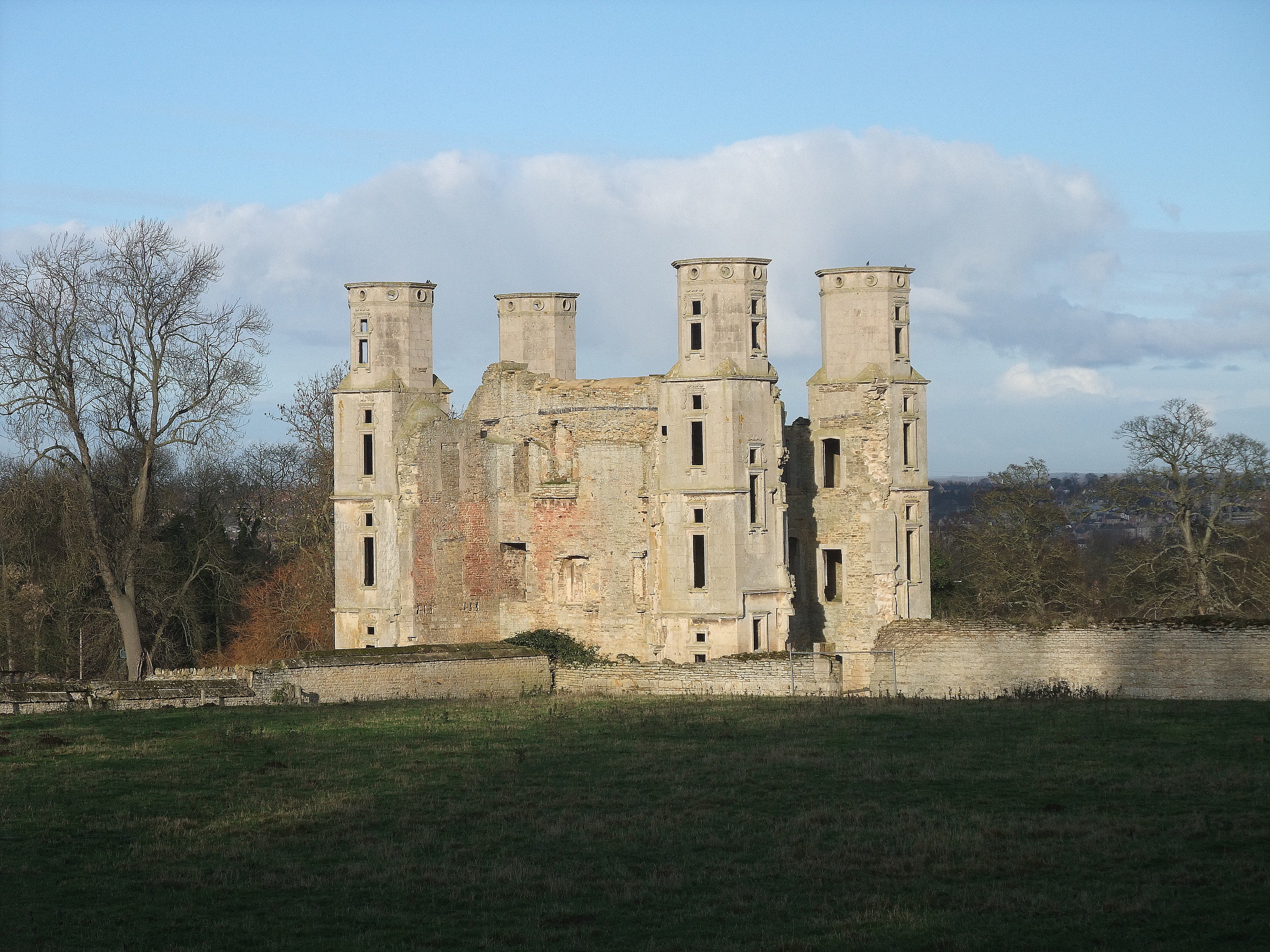
English: Wothorpe Towers, near to Easton on The Hill, Northamptonshire, Great Britain.
Grade I listed. Built by Thomas Cecil, eldest son of Lord Cecil of Burghley, in the early 17th century. Now undergoing extensive restoration <a title="http://www.wothorpe-towers.co.uk/" rel="nofollow" href="http://www.wothorpe-towers.co.uk/">Link</a><img style="padding-left:2px;" alt="External link" title="External link - shift click to open in new window" src="http://s0.geograph.org.uk/img/external.png" width="10" height="10"/> |
| Petsa | |
| Gigikanan | From geograph.org.uk; transferred by User:Skinsmoke using geograph_org2commons. |
| Tagsulat | Tim Heaton |
| Pagtugot (Paggamit pag-usab niini nga file) |
Creative Commons Attribution Share-alike license 2.0 |
| Attribution (required by the license) | Tim Heaton / Wothorpe Towers / |
| Camera location | | View this and other nearby images on: OpenStreetMap |
|---|
| Object location | | View this and other nearby images on: OpenStreetMap |
|---|
_region:GB-GBN_heading:0.00&language=ceb)
Pagtugot

|
This image was taken from the Geograph project collection. See this photograph's page on the Geograph website for the photographer's contact details. The copyright on this image is owned by Tim Heaton and is licensed for reuse under the Creative Commons Attribution-ShareAlike 2.0 license.
|
This file is licensed under the Creative Commons Attribution-Share Alike 2.0 Generic license.
Attribution: Tim Heaton
- Libre ka:
- sa pagsabwag – sa pagkopya, pag-apod-apod ug pagsabwag sa hinimo
- sa pag-remix – sa pag-adap sa binuhat
- Ubos sa mosunod nga mga kondisyon:
- atribusyon – Kinahanglan nimo nga hatagan ang angay nga kredito, maghatag usa ka link sa lisensya, ug ipakita kung adunay mga pagbag-o. Mahimo nimo kini buhaton sa bisan unsang makatarunganon nga paagi, apan dili sa bisan unsang paagi nga nagsugyot nga gi-endorso ka sa licensor o ang imong paggamit.
- share parehas – Kung imong gi-remix, gibag-o, o gibase sa materyal, kinahanglan nimo nga iapod-apod ang imong mga kontribusyon sa ilawom sa parehas o katugma nga lisensya sama sa orihinal.
Kaagi sa payl
I-klik ang petsa/oras aron makit-an ang hulagway sa payl niadtong panahona.
| Petsa/Takna | Thumbnail | Mga dimensyon | Tiggamit | Komento | |
|---|---|---|---|---|---|
| kasamtangan | 02:42, 23 Hulyo 2021 | | 4,000 × 3,000 (4.47 MB) | Geograph Update Bot | Higher-resolution version from Geograph |
| 09:05, 30 Septiyembre 2010 |  | 640 × 480 (62 KB) | File Upload Bot (Magnus Manske) | == {{int:filedesc}} == {{Information |Description={{en|1=Wothorpe Towers, near to Easton on The Hill, Northamptonshire, Great Britain. Grade I listed. Built by Thomas Cecil, eldest son of Lord Cecil of Burghley, in the early 17th century. Now undergoing e |
Mga paggamit sa payl
Ang mosunod nga mga panid misumpay niining payl:
Global nga paggamit sa payl
Kining ubang wiki naggamit ning maong payl:
- Paggamit sa dag.wikipedia.org
- Paggamit sa en.wikipedia.org
- Paggamit sa fr.wikipedia.org
- Paggamit sa sv.wikipedia.org
- Paggamit sa www.wikidata.org
- Paggamit sa zh-min-nan.wikipedia.org