Payl:Yuma County Incorporated and Unincorporated areas Yuma highlighted.svg

Size of this PNG preview of this SVG file: 520 x 600 ka mga piksel. Uban pang mga resoluyon: 208 x 240 ka mga piksel | 416 x 480 ka mga piksel | 666 x 768 ka mga piksel | 887 x 1,024 ka mga piksel | 1,775 x 2,048 ka mga piksel | 650 x 750 ka mga piksel.
Tibuok resolusyon (SVG nga payl, nominally 650 × 750 pixels, size sa payl: 60 KB)
Mubong sugid:
| Deskripsyon |
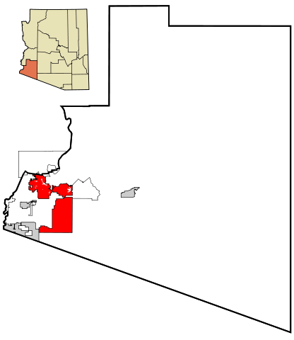
This map shows the incorporated areas and unincorporated areas in Yuma County, Arizona. Data for the borders and locations are based on maps from the Yuma County DDS Mapping Services, US Census Bureau TIGER Map Server, and ITCA Map of Tribal Homelands in Arizona.
|
| Petsa | |
| Gigikanan | My own work, based on public domain information |
| Tagsulat | Ixnayonthetimmay |
| Pagtugot (Paggamit pag-usab niini nga file) |
All rights not reserved. See below. |
| Other versions | See Category:Maps of Yuma County, Arizona for other versions of this image. |
Pagtugot
| I, the copyright holder of this work, release this work into the public domain. This applies worldwide. In some countries this may not be legally possible; if so: I grant anyone the right to use this work for any purpose, without any conditions, unless such conditions are required by law. |
Kaagi sa payl
I-klik ang petsa/oras aron makit-an ang hulagway sa payl niadtong panahona.
| Petsa/Takna | Thumbnail | Mga dimensyon | Tiggamit | Komento | |
|---|---|---|---|---|---|
| kasamtangan | 20:25, 22 Marso 2007 | | 650 × 750 (60 KB) | Ixnayonthetimmay | {{Information |Description=This map shows the incorporated areas and unincorporated areas in Yuma County, Arizona. Yuma is highlighted in r |
Mga paggamit sa payl
Ang mosunod nga mga panid misumpay niining payl:
Global nga paggamit sa payl
Kining ubang wiki naggamit ning maong payl:
- Paggamit sa ar.wikipedia.org
- Paggamit sa arz.wikipedia.org
- Paggamit sa ca.wikipedia.org
- Paggamit sa cy.wikipedia.org
- Paggamit sa de.wikipedia.org
- Paggamit sa el.wikipedia.org
- Paggamit sa eo.wikipedia.org
- Paggamit sa et.wikipedia.org
- Paggamit sa eu.wikipedia.org
- Paggamit sa fa.wikipedia.org
- Paggamit sa fi.wikipedia.org
- Paggamit sa fr.wikipedia.org
- Paggamit sa ga.wikipedia.org
- Paggamit sa he.wikipedia.org
- Paggamit sa ht.wikipedia.org
- Paggamit sa hu.wikipedia.org
- Paggamit sa ia.wikipedia.org
- Paggamit sa id.wikipedia.org
- Paggamit sa ja.wikipedia.org
- Paggamit sa mrj.wikipedia.org
- Paggamit sa pt.wikipedia.org
- Paggamit sa ro.wikipedia.org
- Paggamit sa sco.wikipedia.org
- Paggamit sa sr.wikipedia.org
- Paggamit sa sw.wikipedia.org
- Paggamit sa tr.wikipedia.org
- Paggamit sa tt.wikipedia.org
- Paggamit sa ur.wikipedia.org
- Paggamit sa vo.wikipedia.org
- Paggamit sa www.wikidata.org
- Paggamit sa zh-min-nan.wikipedia.org
- Paggamit sa zh.wikipedia.org