Plantilya:Geobox/doc/Range
< Plantilya:Geobox | doc
| The Rocky Mountains | |
| Range | |
| Mga Nasod | United States, Canada |
|---|---|
| Mga Rehiyon | British Columbia, Alberta, Idaho, Montana, Wyoming, Utah, Colorado, New Mexico |
| Highest point | Mount Elbert |
| - elevation | 14,440 ft (4,401 m) |
| - coordinates | Plantilya:StateAbbr 39°07′04″N 106°26′43″W / 39.11778°N 106.44528°W |
{{Geobox|Range
| name = The Rocky Mountains
| map = RockyMountainsLocatorMap.png
| map_size = 275
| map_alt = Range in western Canada and U.S., from the Alberta – British Columbia border to northern New Mexico
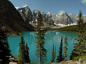
| image = Moraine lake.jpg
| image_size = 275
| image_alt = Pine trees before glacial lake in front of a range of a half-dozen barren peaks with some snow on them
| image_caption = [[Moraine Lake]], and the [[Valley of the Ten Peaks]], [[Banff National Park]], [[Alberta]], [[Canada]]
| country = United States
| country1 = Canada
| country_flag = true
| region = British Columbia
| region1 = Alberta
| region2 = Idaho
| region3 = Montana
| region4 = Wyoming
| region5 = Utah
| region6 = Colorado
| region7 = New Mexico
| highest = Mount Elbert
| highest_elevation_imperial = 14440
| highest_lat_d  =  39 | highest_lat_m  = 07 | highest_lat_s  = 04 | highest_lat_NS  = N
| highest_long_d = 106 | highest_long_m = 26 | highest_long_s = 43 | highest_long_EW = W
}}
See also usba
- {{Infobox mountain range}}, a geobox equivalent specifically for mountain ranges

