Landkreis Bayreuth
Paghimo ni bot Lsjbot. |
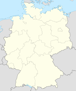
Distrito ang Landkreis Bayreuth sa Alemanya.[1] Nahimutang ni sa distrito nga gobyerno sa Upper Franconia ug estado pederal sa Bavaria, sa sentro nga bahin sa nasod, 300 km sa habagatan sa Berlin ang ulohan sa nasod. Adunay 104,901 ka molupyo.[1] Naglangkob kin og 1,273 ka kilometro kwadrado. Landkreis Bayreuth mopakigbahin sa usa ka utlanan sa Landkreis Forchheim, Bayreuth, Landkreis Lichtenfels, Landkreis Bamberg, Landkreis Kulmbach, Landkreis Hof, Landkreis Wunsiedel im Fichtelgebirge, Landkreis Tirschenreuth, Landkreis Neustadt an der Waldnaab, Landkreis Amberg-Sulzbach, ug Nürnberger Land.
| Landkreis Bayreuth | ||
| Distrito | ||
|
||
| Nasod | ||
|---|---|---|
| Estado pederal | Bavaria | |
| Distrito nga gobyerno | Upper Franconia | |
| Gitas-on | 507 m (1,663 ft) | |
| Tiganos | 49°52′52″N 11°33′57″E / 49.88111°N 11.56583°E | |
| Area | 1,273.00 km2 (492 sq mi) | |
| Population | 104,901 (2014-01-03) [1] | |
| Density | 82 / km2 (212 / sq mi) | |
| Timezone | CET (UTC+1) | |
| - summer (DST) | CEST (UTC+2) | |
| GeoNames | 3220846 | |
Ang yuta sa Landkreis Bayreuth kabungtoran sa amihang-kasadpan, apan sa habagatang-sidlakan nga kini mao ang patag.[saysay 1]
Landkreis Bayreuth may sa mosunod nga mga subdibisyon:
- Heinersreuther Forst
- Waischenfeld
- Pottenstein
- Pegnitz
- Hollfeld
- Goldkronach
- Gefrees
- Creußen
- Betzenstein
- Bad Berneck im Fichtelgebirge
- Plech
- Schnabelwaid
- Weidenberg
- Haag
- Glashütten
- Gesees
- Fichtelberg
- Emtmannsberg
- Eckersdorf
- Bischofsgrün
- Bindlach
- Aufseß
- Ahorntal
- Warmensteinach
- Speichersdorf
- Seybothenreuth
- Prebitz
- Plankenfels
- Mistelgau
- Mistelbach
- Mehlmeisel
- Kirchenpingarten
- Hummeltal
- Heinersreuth
- Bischofsgrüner Forst
- Fichtelberg (obszar wolny administracyjnie)
- Forst Neustädtlein am Forst
- Glashüttener Forst
- Goldkronacher Forst
- Langweiler Wald
- Lindenhardter Forst-Nordwest
- Lindenhardter Forst-Südost
- Neubauer Forst-Nord
- Prüll (powiat Bayreuth)
- Veldensteiner Forst
- Waidacher Forst
- Warmensteinacher Forst-Nord
Hapit nalukop sa lasang nga sagolsagol ang palibot sa Landkreis Bayreuth.[3] Dunay mga 86 ka tawo kada kilometro kwadrado sa palibot sa Landkreis Bayreuth medyo hilabihan populasyon.[4] Ang klima hemiboreal.[5] Ang kasarangang giiniton 7 °C. Ang kinainitan nga bulan Agosto, sa 18 °C, ug ang kinabugnawan Enero, sa −8 °C.[6] Ang kasarangang pag-ulan 1,057 milimetro matag tuig. Ang kinabasaan nga bulan Mayo, sa 123 milimetro nga ulan, ug ang kinaugahan Marso, sa 41 milimetro.[7]
| ||||||||||||||||||||||||||||||||||||||||||||||||||||||||||||||||||||||||||||||||||||||||||||||||||||||||||||||||||||||||||||
Saysay
usbaAng mga gi basihan niini
usba- ↑ 1.0 1.1 1.2 Landkreis Bayreuth sa GeoNames.Org (cc-by); post updated 2014-01-03; database download sa 2015-05-23
- ↑ "Viewfinder Panoramas Digital elevation Model". 2015-06-21.
- ↑ "NASA Earth Observations: Land Cover Classification". NASA/MODIS. Retrieved 30 Enero 2016.
- ↑ "NASA Earth Observations: Population Density". NASA/SEDAC. Retrieved 30 Enero 2016.
- ↑ Peel, M C; Finlayson, B L. "Updated world map of the Köppen-Geiger climate classification". Hydrology and Earth System Sciences. 11: 1633–1644. doi:10.5194/hess-11-1633-2007. Retrieved 30 Enero 2016.
{{cite journal}}: CS1 maint: unflagged free DOI (link) - ↑ 6.0 6.1 "NASA Earth Observations Data Set Index". NASA. Retrieved 30 Enero 2016.
- ↑ "NASA Earth Observations: Rainfall (1 month - TRMM)". NASA/Tropical Rainfall Monitoring Mission. Retrieved 30 Enero 2016.
Gikan sa gawas nga tinubdan
usba| Aduna'y mga payl ang Wikimedia Commons nga may kalabotan sa artikulong: Landkreis Bayreuth. |


